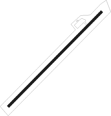
Stevenson
Airport details
| Country | United States of America |
| State | Alabama |
| Region | K7 |
| Airspace | Memphis Ctr |
| Municipality | Jackson County |
| Elevation | 644ft (196m) |
| Timezone | GMT -6 |
| Coordinates | 34.88628, -85.80329 |
| Magnetic var | |
| Type | land |
| Available since | X-Plane v10.40 |
| ICAO code | 7A6 |
| IATA code | n/a |
| FAA code | n/a |
Communication
| Stevenson CTAF/UNICOM | 122.800 |
Nearby Points of Interest:
Fort Harker
-General William Rosecrans Headquarters
-Bridgeport Historic District
-McKendree Methodist Episcopal Church
-Dade County Courthouse
-Marion Memorial Bridge
-Skyline Commissary
-College Hill Historic District
-Scottsboro Memphis and Charleston Railroad Depot
-Public Square Historic District
-Brown-Proctor House
-Cowan Tunnel
-Dancy-Polk House
-Sewanee Fire Lookout Tower
-Dr. J.A. Gorman House
-Winston Place
-Tennessee River Blueway
-Vance C. Larmore House
-Col. A.M. Shook House
-Franklin County Courthouse
-Haynes House
-Estill-Fite House
-Lookout Mountain Incline Railway
-Wauhatchie Pike
-Chickamauga Lodge No. 221, Free and Accepted Masons, Prince Hall Affiliate
Runway info
| Runway 5 / 23 | ||
| length | 1249m (4098ft) | |
| bearing | 55° / 235° | |
| width | 24m (80ft) | |
| surface | asphalt | |
| displ threshold | 261m (856ft) / 267m (876ft) | |
Nearby beacons
| code | identifier | dist | bearing | frequency |
|---|---|---|---|---|
| GQO | CHOO CHOO (CHATTANOOGA) VORTAC | 32.3 | 83° | 115.80 |
| CQN | DAISY (N.CHATTANOOGA) NDB | 35.9 | 67° | 341 |
| RQZ | ROCKET (HUNTSVILLE) VORTAC | 41.2 | 264° | 112.20 |
| SYI | SHELBYVILLE VOR/DME | 51.1 | 317° | 113.55 |
| RMG | ROME VORTAC | 55 | 137° | 115.40 |
| DTE | MARK ANTON (DAYTON) NDB | 55.7 | 56° | 394 |
| GAD | GADSDEN VOR/DME | 56.3 | 197° | 112.30 |
| HCH | HINCH MTN (CROSSVILLE) VOR/DME | 67.2 | 43° | 117.60 |
Disclaimer
The information on this website is not for real aviation. Use this data with the X-Plane flight simulator only! Data taken with kind consent from X-Plane 12 source code and data files. Content is subject to change without notice.
