Spruce Pine - Avery County Morrison Field
Airport details
| Country | United States of America |
| State | North Carolina |
| Region | K7 |
| Airspace | Atlanta Ctr |
| Municipality | Avery County |
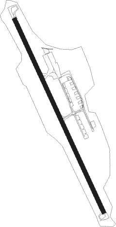
| Elevation | 2745ft (837m) |
| Timezone | GMT -5 |
| Coordinates | 35.94805, -81.99690 |
| Magnetic var | |
| Type | land |
| Available since | X-Plane v10.32 |
| ICAO code | 7A8 |
| IATA code | n/a |
| FAA code | n/a |
Communication
| Avery County Morrison Field CTAF/UNICOM | 123.000 |
Nearby Points of Interest:
Downtown Spruce Pine Historic District
-Penland Post Office and General Store
-Church of the Resurrection
-Mitchell County Courthouse
-Avery County Courthouse
-Avery County Jail
-Elk Park School
-Yancey Collegiate Institute Historic District
-Citizens Bank Building
-Yancey County Courthouse
-John T. Wilder House
-Main Street Historic District (Marion, North Carolina)
-First Presbyterian Church
-McDowell County Courthouse
-St. Matthew's Lutheran Church
-Depot Historic District
-Nuckolls-Jefferies House
-Mulberry Chapel Methodist Church
-Mount Mitchell State Park
-Bellevue
-Quaker Meadows
-Valle Crucis Episcopal Mission
-Markham-Albertson-Stinson Cottage
-John N. Peterson Farm
-Mast Farm
Nearby beacons
| code | identifier | dist | bearing | frequency |
|---|---|---|---|---|
| BAR | HEMLOCK (BANNER ELK) NDB | 13.5 | 30° | 320 |
| FIQ | FIDDLERS (MORGANTON) NDB | 21.3 | 126° | 391 |
| JJC | MOUNTAIN CITY NDB | 29.3 | 20° | 396 |
| HMV | HOLSTON MOUNTAIN VORTAC | 30 | 345° | 114.60 |
| HK | TAWBA (HICKORY) NDB | 35 | 103° | 332 |
| SUG | SUGARLOAF MT. (ASHEVILLE) VORTAC | 35.1 | 207° | 112.20 |
| BO | BOOIE (BRISTOL) NDB | 36.3 | 312° | 221 |
| BZM | BARRETTS MOUNTAIN (HICKOR VOR/DME | 37 | 96° | 113.75 |
| IM | KEANS (ASHEVILLE) NDB | 38 | 235° | 357 |
| TR | MOCCA(BRISTOL-JOHNSON-KINGSPOR NDB | 39.6 | 332° | 299 |
| JUH | ASHEE (JEFFERSON) NDB | 43.8 | 54° | 410 |
| SLP | FIRST RIVER (SHELBY) NDB | 46 | 150° | 417 |
| BRA | BROAD RIVER (ASHEVILLE) NDB | 46.6 | 215° | 379 |
| RVN | ROGERSVILLE NDB | 52.7 | 300° | 329 |
| GZG | GLADE SPRING (BLACKFORD) VOR/DME | 52.8 | 355° | 110.20 |
| SPA | SPARTANBURG VORTAC | 55 | 176° | 115.70 |
| GHJ | STONIA (GASTONIA) NDB | 61.1 | 132° | 260 |
Disclaimer
The information on this website is not for real aviation. Use this data with the X-Plane flight simulator only! Data taken with kind consent from X-Plane 12 source code and data files. Content is subject to change without notice.