Kenmare - Kenmare Muni
Airport details
| Country | United States of America |
| State | North Dakota |
| Region | K3 |
| Airspace | Minneapolis Ctr |
| Municipality | Kenmare |
| Elevation | 1959ft (597m) |
| Timezone | GMT -6 |
| Coordinates | 48.66761, -102.04800 |
| Magnetic var | |
| Type | land |
| Available since | X-Plane v10.40 |
| ICAO code | 7K5 |
| IATA code | n/a |
| FAA code | n/a |
Communication
| Kenmare Muni CTAF | 122.800 |
| Kenmare Muni MINOT Approach | 119.600 |
| Kenmare Muni MINOT Departure | 119.600 |
Nearby Points of Interest:
Burke County World War Memorial Hall
-Renville County Courthouse
-Mountrail County Courthouse
Runway info
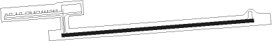
| Runway 8 / 26 | ||
| length | 1129m (3704ft) | |
| bearing | 90° / 270° | |
| width | 18m (60ft) | |
| surface | asphalt | |
Nearby beacons
| code | identifier | dist | bearing | frequency |
|---|---|---|---|---|
| MIB | DEERING (MINOT) TACAN | 31 | 110° | 114.90 |
| MOT | MINOT VOR/DME | 38.9 | 118° | 117.10 |
Instrument approach procedures
| runway | airway (heading) | route (dist, bearing) |
|---|---|---|
| RW26 | EWIRU (270°) | EWIRU 3900ft |
| RW26 | IJKOJ (252°) | IJKOJ EWIRU (5mi, 180°) 3900ft |
| RW26 | MOT (298°) | MOT ULSUW (28mi, 303°) 3900ft EWIRU (5mi, 0°) 3900ft |
| RNAV | EWIRU 3900ft OZFEJ (5mi, 270°) 3600ft 7K5 (5mi, 270°) 1995ft (5881mi, 115°) 2362ft EWRAF (5891mi, 295°) 4000ft EWRAF (turn) |
Disclaimer
The information on this website is not for real aviation. Use this data with the X-Plane flight simulator only! Data taken with kind consent from X-Plane 12 source code and data files. Content is subject to change without notice.