So. Sioux City - Martin Field
Airport details
| Country | United States of America |
| State | Nebraska |
| Region | K3 |
| Airspace | Minneapolis Ctr |
| Municipality | Dakota County |
| Elevation | 1100ft (335m) |
| Timezone | GMT -6 |
| Coordinates | 42.45416, -96.47253 |
| Magnetic var | |
| Type | land |
| Available since | X-Plane v10.40 |
| ICAO code | 7K8 |
| IATA code | n/a |
| FAA code | 7K8 |
Communication
| Martin Field CTAF/UNICOM | 122.800 |
Nearby Points of Interest:
Theophile Bruguier Cabin
-Meisch House
-Sioux City Public Library
-Federal Building and United States Courthouse
-T.S. Martin and Company
-Badgerow Building
-Williges Building
-Davidson Building
-Motor Mart Building
-Sioux City Free Public Library
-Sioux City Linseed Oil Works
-Boston Block
-Fourth Street Historic District
-Sioux City Masonic Temple
-Alhambra Apartments
-Evans Block
-Sioux City Fire Station Number 3
-Rose Hill Historic District
-First Congregational Church, Former
-Sioux City Central High School and Central Annex
-Elzy G. Burkam House
-Atchison A. Ashby House
-Mount Sinai Temple (Sioux City, Iowa)
-Arthur and Stella Sanford House
-KD Station
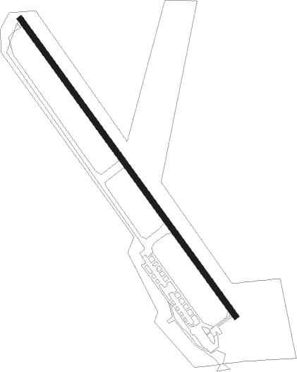
Runway info
| Runway 14 / 32 | ||
| length | 1014m (3327ft) | |
| bearing | 140° / 320° | |
| width | 15m (50ft) | |
| surface | asphalt | |
| displ threshold | 0m (0ft) / 201m (659ft) | |
Nearby beacons
| code | identifier | dist | bearing | frequency |
|---|---|---|---|---|
| OI | TOMMI (SIOUX CITY) NDB | 0.5 | 60° | 305 |
| SUX | SIOUX CITY TACAN | 9.3 | 126° | 116.50 |
| SU | SALIX (SOUIX CITY) NDB | 11 | 125° | 414 |
| YK | CAGUR (YANKTON) NDB | 43.4 | 295° | 347 |
| YKN | YANKTON VOR/DME | 48.9 | 297° | 111.40 |
| OFK | NORFOLK VOR/DME | 51.1 | 244° | 109.60 |
| SCB | SCRIBNER VOR/DME | 51.4 | 190° | 111 |
| PLT | PLATTE CENTER (COLUMBUS) NDB | 70.3 | 224° | 407 |
Disclaimer
The information on this website is not for real aviation. Use this data with the X-Plane flight simulator only! Data taken with kind consent from X-Plane 12 source code and data files. Content is subject to change without notice.