Osceola - Osceola Municipal
Airport details
| Country | United States of America |
| State | Arkansas |
| Region | K4 |
| Airspace | Memphis Ctr |
| Municipality | Osceola |
| Elevation | 233ft (71m) |
| Timezone | GMT -6 |
| Coordinates | 35.69114, -90.01011 |
| Magnetic var | |
| Type | land |
| Available since | X-Plane v10.40 |
| ICAO code | 7M4 |
| IATA code | n/a |
| FAA code | 7M4 |
Communication
| Osceola Municipal CTAF/UNICOM | 122.800 |
| Osceola Municipal MEMPHIS ApproachROACH | 119.100 |
| Osceola Municipal MEMPHIS DepartureARTURE | 119.100 |
Nearby Points of Interest:
Florida Brothers Building
-City Hall
-Mississippi County Jail
-Mississippi County Courthouse
-Osceola Times Building
-Bank of Osceola
-Wilson Residential Historic District
-Wilson Community House
-Wilson Commercial Historic District
-Wilson High School Gymnasium
-Herman Davis State Park
-Jonesboro, Lake City & Eastern Railroad Depot
-West Main Street Residential Historic District
-Blytheville Greyhound Bus Station
-Kress Building
-Lepanto Commercial Historic District
-First National Bank Building
-Tyronza Methodist Episcopal Church, South
-Highway A-7, Gilmore to Turrell
-Old Turrell City Hall
-Campbell Archeological Site
-Lauderdale County Courthouse
-Craighead County Road 513C Bridge
-Maxie Theatre
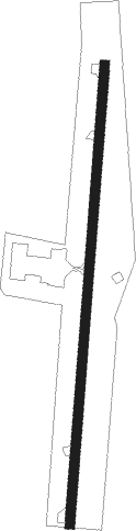
Runway info
| Runway 1 / 19 | ||
| length | 1161m (3809ft) | |
| bearing | 11° / 191° | |
| width | 23m (75ft) | |
| surface | asphalt | |
Nearby beacons
| code | identifier | dist | bearing | frequency |
|---|---|---|---|---|
| JBR | JONESBORO VOR/DME | 30.2 | 288° | 108.60 |
| GQE | GILMORE VOR/DME | 30.8 | 234° | 113 |
| DYR | DYERSBURG VORTAC | 39 | 65° | 116.80 |
| MEM | MEMPHIS VORTAC | 40.6 | 178° | 117.50 |
| MAW | MALDEN VORTAC | 52.1 | 7° | 111.20 |
| ARG | WALNUT RIDGE VORTAC | 52.3 | 294° | 114.50 |
| TNZ | LAWRENCE COUNTY (WALNUT RIDGE) NDB | 54.1 | 299° | 227 |
| HLI | HOLLY SPRINGS VORTAC | 60.7 | 151° | 112.40 |
Instrument approach procedures
| runway | airway (heading) | route (dist, bearing) |
|---|---|---|
| RW19 | UKUCI (191°) | UKUCI 3000ft |
| RW19 | YALUL (218°) | YALUL 3000ft UKUCI (5mi, 277°) 3000ft |
| RW19 | ZARAM (162°) | ZARAM 3000ft UKUCI (5mi, 97°) 3000ft |
| RNAV | UKUCI 3000ft WORUP (6mi, 191°) 1900ft 7M4 (5mi, 191°) 274ft NOBDY (8mi, 191°) 3500ft NOBDY (turn) |
Disclaimer
The information on this website is not for real aviation. Use this data with the X-Plane flight simulator only! Data taken with kind consent from X-Plane 12 source code and data files. Content is subject to change without notice.