Sweetgrass - Ross International
Airport details
| Country | Canada |
| State | Alberta |
| Region | |
| Airspace | Salt Lake City Ctr |
| Municipality | County of Warner |
| Elevation | 3550ft (1082m) |
| Timezone | GMT -7 |
| Coordinates | 48.99853, -111.98426 |
| Magnetic var | |
| Type | land |
| Available since | X-Plane v10.40 |
| ICAO code | 7S8 |
| IATA code | n/a |
| FAA code | 7S8 |
Communication
| Ross International CTAF | 122.800 |
Nearby Points of Interest:
Bethany Lutheran Church
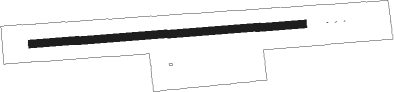
Runway info
| Runway 07 / 25 | ||
| length | 866m (2841ft) | |
| bearing | 90° / 270° | |
| width | 24m (80ft) | |
| surface | grass | |
| blast zone | 0m (0ft) / 62m (203ft) | |
Nearby beacons
| code | identifier | dist | bearing | frequency |
|---|---|---|---|---|
| CTB | CUT BANK VOR/DME | 29.6 | 220° | 113.35 |
| 6T | FOREMOST NDB | 35.1 | 46° | 362 |
| YQL | LETHBRIDGE VOR/DME | 46.6 | 313° | 115.70 |
| QL | LETHBRIDGE NDB | 50.9 | 304° | 248 |
Disclaimer
The information on this website is not for real aviation. Use this data with the X-Plane flight simulator only! Data taken with kind consent from X-Plane 12 source code and data files. Content is subject to change without notice.