Acme - Seven Springs
Airport details
| Country | United States of America |
| State | Pennsylvania |
| Region | |
| Airspace | Cleveland Ctr |
| Municipality | Saltlick Township |
| Elevation | 2907ft (886m) |
| Timezone | GMT -5 |
| Coordinates | 40.00992, -79.32731 |
| Magnetic var | |
| Type | land |
| Available since | X-Plane v10.40 |
| ICAO code | 7SP |
| IATA code | n/a |
| FAA code | n/a |
Communication
| Seven Springs CTAF | 122.900 |
Nearby Points of Interest:
Miller's Store
-Kooser State Park Family Cabin District
-Pennsylvania Railroad 3750
-Penrose Wolf Building
-Linn Run State Park Family Cabin District
-Peter and Jonathan Newmyer Farm
-Uptown Somerset Historic District
-Somerset County Courthouse
-Daniel B. Zimmerman Mansion
-Carnegie Free Library
-Colonial National Bank Building
-United States Post Office
-Dr. J.C. McClenathan House and Office
-Connellsville Armory
-Kentuck Knob
-Connellsville Union Passenger Depot
-Mount Pleasant Historic District
-Samuel Warden House
-Scottdale Armory
-Scottdale Historic District
-Ligonier Historic District
-Ligonier Armory
-Adam Fisher Homestead
-Cochran Memorial United Methodist Church
-Isaac Meason House
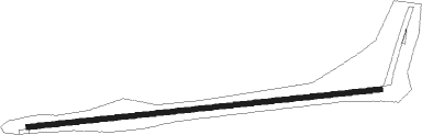
Runway info
| Runway 10 / 28 | ||
| length | 925m (3035ft) | |
| bearing | 89° / 269° | |
| width | 13m (42ft) | |
| surface | asphalt | |
| blast zone | 28m (92ft) / 47m (154ft) | |
Nearby beacons
| code | identifier | dist | bearing | frequency |
|---|---|---|---|---|
| IHD | INDIAN HEAD VORTAC | 2.5 | 221° | 108.20 |
| SYS | STOYSTOWN (SOMERSET) NDB | 19.4 | 80° | 209 |
| VV | CAMOR (CONNELLSVILLE) NDB | 20.6 | 253° | 299 |
| GRV | DME | 25.8 | 144° | 112.30 |
| JST | JOHNSTOWN VOR/DME | 29.1 | 58° | 113 |
| AGC | ALLEGHENY (PITTSBURGH) VOR/DME | 36.5 | 291° | 110 |
| MGW | MORGANTOWN VOR/DME | 36.6 | 230° | 111.60 |
| REC | REVLOC VOR/DME | 41.7 | 47° | 110.60 |
| MMJ | (PITTSBURGH) DME | 49 | 299° | 112 |
| ESL | KESSEL VOR/DME | 49.6 | 157° | 110.80 |
| CKB | CLARKSBURG VOR/DME | 62.9 | 231° | 112.60 |
| EWC | ELLWOOD CITY VOR/DME | 63.4 | 313° | 115.80 |
Disclaimer
The information on this website is not for real aviation. Use this data with the X-Plane flight simulator only! Data taken with kind consent from X-Plane 12 source code and data files. Content is subject to change without notice.