Red Cloud - Red Cloud Muni
Airport details
| Country | United States of America |
| State | Nebraska |
| Region | K3 |
| Airspace | Minneapolis Ctr |
| Municipality | Webster County |
| Elevation | 1744ft (532m) |
| Timezone | GMT -6 |
| Coordinates | 40.08216, -98.54136 |
| Magnetic var | |
| Type | land |
| Available since | X-Plane v10.40 |
| ICAO code | 7V7 |
| IATA code | n/a |
| FAA code | 7V7 |
Communication
| Red Cloud Muni CTAF | 122.900 |
Nearby Points of Interest:
Warner-Cather House
-Webster County Courthouse
-Farmer's and Merchant's Bank Building
-Auld Public Library
-Matthew R. Bentley House
-IOOF Hall and Opera House
-Burr Oak United Methodist Church
-Lawrence Opera House
-Home on the Range Cabin
-Wallace Warren and Lillian Genevieve Bradshaw Kendall House
-Nelson Cemetery Walk
-Nuckolls County Courthouse
-Jewell County Courthouse
-First Congregational Church, U.C.C.
-Glenville School
-Fairfield Carnegie Library
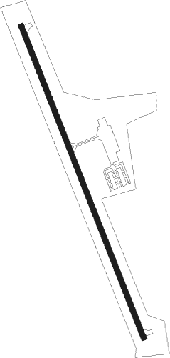
Runway info
| Runway 16 / 34 | ||
| length | 1130m (3707ft) | |
| bearing | 158° / 338° | |
| width | 18m (60ft) | |
| surface | concrete | |
Nearby beacons
| code | identifier | dist | bearing | frequency |
|---|---|---|---|---|
| TKO | MANKATO VORTAC | 21 | 134° | 109.80 |
| HSI | HASTINGS VOR/DME | 31.7 | 12° | 108.80 |
| EAR | KEARNEY VOR | 44 | 324° | 111.20 |
| GR | SANCY NDB | 48.6 | 16° | 380 |
| FMZ | BEKLOF (FAIRMONT) NDB | 53.9 | 62° | 392 |
| GRI | GRAND ISLAND VOR/DME | 55.1 | 14° | 112 |
| JYR | YORK NDB | 64.6 | 49° | 257 |
Instrument approach procedures
| runway | airway (heading) | route (dist, bearing) |
|---|---|---|
| RW16 | HSI (192°) | HSI ZOXEP (18mi, 220°) 4500ft EKIMY (6mi, 158°) 3600ft |
| RW16 | KOTZA (343°) | KOTZA EKIMY (31mi, 341°) 3600ft EKIMY (turn) 3600ft |
| RW16 | MORGS (160°) | MORGS ZOXEP (20mi, 162°) 4500ft EKIMY (6mi, 158°) 3600ft |
| RW16 | TKO (314°) | TKO EKIMY (31mi, 322°) 3600ft EKIMY (turn) 3600ft |
| RNAV | EKIMY 3600ft FESIG (5mi, 158°) 3600ft WUTKI (3mi, 158°) 2540ft 7V7 (3mi, 158°) 1788ft (5797mi, 112°) 2075ft CAGNA (5795mi, 292°) 3500ft CAGNA (turn) | |
| RW34 | HSI (192°) | HSI CAGNA (42mi, 184°) 4000ft CAGNA (turn) 3500ft |
| RW34 | KOTZA (343°) | KOTZA CAGNA (9mi, 349°) 3500ft |
| RW34 | TKO (314°) | TKO CAGNA (12mi, 296°) 3500ft |
| RNAV | CAGNA 3500ft AZEYO (5mi, 338°) 3500ft RORCO (3mi, 338°) 2580ft 7V7 (3mi, 338°) 1757ft (5797mi, 112°) 2027ft EKIMY (5799mi, 292°) 3600ft EKIMY (turn) |
Disclaimer
The information on this website is not for real aviation. Use this data with the X-Plane flight simulator only! Data taken with kind consent from X-Plane 12 source code and data files. Content is subject to change without notice.