Engelhard - Hyde County
Airport details
| Country | United States of America |
| State | North Carolina |
| Region | K7 |
| Airspace | Washington Ctr |
| Municipality | Hyde County |
| Elevation | 3ft (1m) |
| Timezone | GMT -5 |
| Coordinates | 35.56204, -75.95566 |
| Magnetic var | |
| Type | land |
| Available since | X-Plane v10.40 |
| ICAO code | 7W6 |
| IATA code | n/a |
| FAA code | 7W6 |
Communication
| Hyde County AWOS | 119.275 |
| Hyde County CTAF/UNICOM | 122.700 |
| Hyde County CHERRY POINT Approach/Departure | 124.725 |
Nearby Points of Interest:
Inkwell (Lake Landing, North Carolina)
-Lake Mattamuskeet Pump Station
-Rasmus Midgett House
-Ellsworth and Lovie Ballance House
-Bodie Island Light Station
-John T. Daniels House
-Theodore S. Meekins House
-George Washington Creef House
-Bodie Island Lifesaving and Coast Guard Station
-Tyrrell County Courthouse
-Columbia Historic District
-Scuppernong River Bridge
-Creswell Historic District
-Mattie Midgett Store and House
-Nags Head Beach Cottages Historic District
-Sam's Diner
Runway info
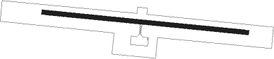
| Runway 11 / 29 | ||
| length | 1433m (4701ft) | |
| bearing | 98° / 278° | |
| width | 30m (100ft) | |
| surface | asphalt | |
Nearby beacons
| code | identifier | dist | bearing | frequency |
|---|---|---|---|---|
| MQI | MANTEO NDB | 24.7 | 36° | 370 |
| RBX | WRIGHT BROTHERS (MANTEO) VOR/DME | 24.9 | 36° | 111.60 |
| ECG | ELIZABETH CITY VOR/DME | 43.1 | 342° | 112.50 |
| LLW | WOODVILLE (ELIZABETH CITY) NDB | 45.2 | 334° | 254 |
| NKT | CHERRY POINT TACAN | 60 | 234° | 112.80 |
| CVI | COFIELD VORTAC | 65.9 | 312° | 114.60 |
Instrument approach procedures
| runway | airway (heading) | route (dist, bearing) |
|---|---|---|
| RW11 | PUNGO (96°) | PUNGO FANDU (13mi, 93°) 2500ft |
| RNAV | FANDU 2500ft LULUZ (6mi, 98°) 1700ft WINAS (4mi, 98°) 520ft 7W6 (2mi, 98°) 51ft (4721mi, 115°) 500ft PUNGO (4746mi, 295°) 3000ft PUNGO (turn) |
Disclaimer
The information on this website is not for real aviation. Use this data with the X-Plane flight simulator only! Data taken with kind consent from X-Plane 12 source code and data files. Content is subject to change without notice.