Oxford - Oxford Co Regl
Airport details
| Country | United States of America |
| State | Maine |
| Region | K6 |
| Airspace | Boston Ctr |
| Municipality | Oxford |
| Elevation | 346ft (105m) |
| Timezone | GMT -5 |
| Coordinates | 44.15744, -70.48128 |
| Magnetic var | |
| Type | land |
| Available since | X-Plane v10.40 |
| ICAO code | 81B |
| IATA code | n/a |
| FAA code | n/a |
Communication
| Oxford Co Regl CTAF/UNICOM | 122.800 |
| Oxford Co Regl PORTLAND Approach/Departure | 125.500 |
Nearby Points of Interest:
Center Meeting House and Common
-Robinson-Parsons Farm
-Levi Sargent House
-McLaughlin House and Garden
-Sturtevant Hall
-Hersey Plow Company Building
-Paris Public Library
-Samuel Penney House
-George Seaverns House
-Ryefield Bridge
-Bell Hill School
-Former Otisfield Town House
-Nutting Homestead
-Churchill Bridge
-Poland Railroad Station
-Keystone Mineral Springs
-Deertrees Theatre
-McWain-Hall House
-Poland Spring Beach House
-Poland Springs Historic District
-Caswell Public Library
-Poland Spring Bottling Plant and Spring House
-Zadoc Long Free Library
-Stearns Hill Farm
-Enoch Hall House
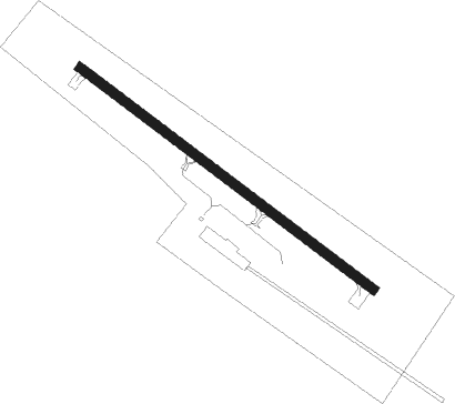
Runway info
| Runway 15 / 33 | ||
| length | 913m (2995ft) | |
| bearing | 122° / 302° | |
| width | 23m (75ft) | |
| surface | asphalt | |
Nearby beacons
| code | identifier | dist | bearing | frequency |
|---|---|---|---|---|
| LE | LEWIE (AUBURN-LEWISTON) NDB | 13.2 | 144° | 240 |
| AU | DUNNS (AUGUSTA) NDB | 30.7 | 68° | 366 |
| AUG | AUGUSTA VOR/DME | 31 | 77° | 114.95 |
| BML | DME | 41.6 | 304° | 116.55 |
| ENE | KENNEBUNK VOR/DME | 44.3 | 190° | 117.10 |
| RQM | RANGELEY NDB | 48 | 341° | 221 |
| SF | SANFD (SANFORD) NDB | 51.7 | 203° | 349 |
| ESG | ROLLINS (ROLLINSFORD) NDB | 58.2 | 200° | 260 |
Instrument approach procedures
| runway | airway (heading) | route (dist, bearing) |
|---|---|---|
| RW15 | LABEL (37°) | LABEL JEXEN (30mi, 10°) 4100ft JEXEN (turn) 3700ft EKICA (2mi, 122°) 3100ft |
| RW15 | NOLLI (275°) | NOLLI JEXEN (25mi, 286°) 3700ft JEXEN (turn) 3700ft EKICA (2mi, 122°) 3100ft |
| RNAV | EKICA 3100ft BERVE (3mi, 122°) 2300ft IBUNY (3mi, 122°) 1400ft 81B (3mi, 122°) 385ft (4572mi, 122°) 745ft SPDWY (4563mi, 302°) 3600ft SPDWY (turn) | |
| RW33 | LABEL (37°) | LABEL SPDWY (25mi, 61°) 3600ft SPDWY (turn) 3600ft |
| RW33 | NOLLI (275°) | NOLLI SPDWY (8mi, 240°) 3600ft |
| RNAV | SPDWY 3600ft BUKRE (4mi, 303°) 2300ft 81B (6mi, 303°) 377ft (4572mi, 122°) 745ft JEXEN (4582mi, 302°) 3700ft JEXEN (turn) |
Disclaimer
The information on this website is not for real aviation. Use this data with the X-Plane flight simulator only! Data taken with kind consent from X-Plane 12 source code and data files. Content is subject to change without notice.