Cleveland - Mountain Airpark
Airport details
| Country | United States of America |
| State | Georgia |
| Region | |
| Airspace | Atlanta Ctr |
| Municipality | White County |
| Elevation | 1437ft (438m) |
| Timezone | GMT -5 |
| Coordinates | 34.56509, -83.71429 |
| Magnetic var | |
| Type | land |
| Available since | X-Plane v10.40 |
| ICAO code | 83A |
| IATA code | n/a |
| FAA code | 0GE5 |
Communication
Nearby Points of Interest:
Sautee Valley Historic District
-Mauldin House
-Henry Asbury House
-Fort Hollingsworth–White House
-Lumpkin County Jail
-Price Memorial Hall
-Fields Place-Vickery House
-Calhoun Mine
-Walasi-Yi Interpretive Center
-Blood Mountain Shelter
-Federal Building and U.S. Courthouse
-Old Hall County Courthouse
-Gainesville Commercial Historic District
-Beulah Rucker House-School
-Jacks Knob Trail
-Tallulah Falls School
-James B. Simmons House
-Stephens County Courthouse
-Arkaquah Trail
-Boyd and Sallie Gilleland House
-Old Union County Courthouse
-Old Union County Jail
-Walnut Hill Historic District
-Jarrett-Hayes House
-Towns County Jail
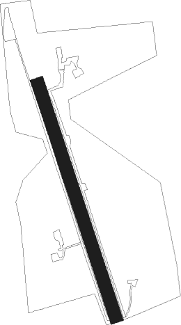
Runway info
| Runway 18 / 36 | ||
| length | 763m (2503ft) | |
| bearing | 163° / 343° | |
| width | 40m (131ft) | |
| surface | grass | |
Nearby beacons
| code | identifier | dist | bearing | frequency |
|---|---|---|---|---|
| ODF | FOOTHILLS (TOCCOA) VOR/DME | 22 | 73° | 113.40 |
| FKV | FLOWERY BRANCH (GAINESVILLE) NDB | 23.7 | 208° | 365 |
| HRS | HARRIS VORTAC | 24.7 | 332° | 109.80 |
| TX | GWNET (LAWRENCEVILLE) NDB | 33.5 | 195° | 419 |
| BMW | BARROW COUNTY (WINDER) NDB | 38.3 | 169° | 404 |
| AHN | ATHENS VOR/DME | 41.8 | 148° | 109.60 |
| DJD | CHERO NDB | 42.6 | 248° | 415 |
| ELW | ELECTRIC CITY (ANDERSON) VORTAC | 46.8 | 99° | 108.60 |
| PDK | PEACHTREE (ATLANTA) VOR/DME | 50.5 | 220° | 116.60 |
| DOB | DOBBINS (MARIETTA) TACAN | 55.4 | 231° | 113 |
| VOF | ALCOVY (COVINGTON) NDB | 56.2 | 184° | 370 |
| VV | JUNNE (GREENSBORO) NDB | 65 | 143° | 353 |
| ATL | ATLANTA VORTAC | 66.6 | 218° | 116.90 |
| AT | CATTA (ATLANTA) NDB | 68.8 | 222° | 375 |
Disclaimer
The information on this website is not for real aviation. Use this data with the X-Plane flight simulator only! Data taken with kind consent from X-Plane 12 source code and data files. Content is subject to change without notice.