Rush - Skyview
Airport details
| Country | United States of America |
| State | New York |
| Region | |
| Airspace | Cleveland Ctr |
| Municipality | Town of Rush |
| Elevation | 642ft (196m) |
| Timezone | GMT -5 |
| Coordinates | 42.98490, -77.61687 |
| Magnetic var | |
| Type | land |
| Available since | X-Plane v10.40 |
| ICAO code | 84NY |
| IATA code | n/a |
| FAA code | 84NY |
Communication
Nearby Points of Interest:
Gates-Livermore Cobblestone Farmhouse
-United States Post Office
-Adsit Cobblestone Farmhouse
-Honeoye Falls Village Historic District
-Markham Cobblestone Farmhouse and Barn Complex
-Godfrey House and Barn Complex
-Martin Farm Complex
-Stewart Cobblestone Farmhouse
-Whitcomb Cobblestone Farmhouse
-Antoinette Louisa Brown Blackwell Childhood Home
-Leech-Parker Farmhouse
-Alverson-Copeland House
-Leech-Lloyd Farmhouse and Barn Complex
-Draper House
-Matthew Warner House
-William DePuy House
-Cargill House
-William Harmon House (Lima, New York)
-William L. Vary House
-J. Franklin Peck House
-Stanley House
-Spencer House
-Lima Village Historic District
-Harden House
-Hillcrest
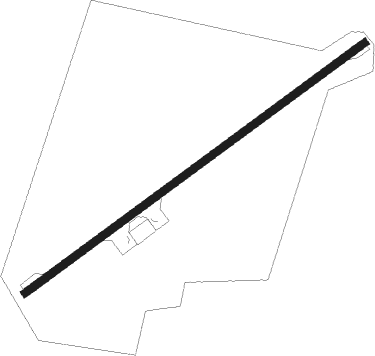
Runway info
| Runway 7 / 25 | ||
| length | 602m (1975ft) | |
| bearing | 66° / 246° | |
| width | 11m (35ft) | |
| surface | asphalt | |
| displ threshold | 23m (75ft) / 0m (0ft) | |
Nearby beacons
| code | identifier | dist | bearing | frequency |
|---|---|---|---|---|
| ROC | ROCHESTER VOR/DME | 8.3 | 337° | 110 |
| GEE | GENESEO VOR/DME | 10.3 | 218° | 108.20 |
| PYA | PENN YAN NDB | 32 | 121° | 260 |
| ELZ | DME | 56.3 | 203° | 111.40 |
| ALP | ALPINE (ELMIRA) NDB | 58.5 | 131° | 245 |
| ULW | ELMIRA VOR/DME | 59.5 | 146° | 109.65 |
Disclaimer
The information on this website is not for real aviation. Use this data with the X-Plane flight simulator only! Data taken with kind consent from X-Plane 12 source code and data files. Content is subject to change without notice.