Bloomfield - Bloomfield Muni
Airport details
| Country | United States of America |
| State | Nebraska |
| Region | |
| Airspace | Minneapolis Ctr |
| Municipality | Knox County |
| Elevation | 1672ft (510m) |
| Timezone | GMT -6 |
| Coordinates | 42.58215, -97.67598 |
| Magnetic var | |
| Type | land |
| Available since | X-Plane v10.40 |
| ICAO code | 84Y |
| IATA code | n/a |
| FAA code | 84Y |
Communication
Nearby Points of Interest:
Pospeshil Theatre
-Knox County Courthouse
-Argo Hotel
-Winnetoon Jail
-Plainview Carnegie Library
-Fremont, Elkhorn and Missouri Valley Railroad Depot
-Z.C.B.J. Opera House
-Church of Our Most Merciful Saviour
-Congregational Church and Manse
-Hartington Hotel
-Cedar County Courthouse
-Hartington City Hall and Auditorium
-Ponca Tribal Self-Help Community Building Historic District
-Dr. John Trierweiler House
-Harold A. (H.A.) Doyle House
-Dr. B.M. Banton House
-Governor John L. Pennington House
-Chicago, Milwaukee and St. Paul Depot
-Yankton College
-Old St. Wenceslaus Catholic Parish House
-St. Wenceslaus Catholic Church and Parish House
-Mathias Merkwan Rubblestone Barn
-Human Services Center
-Verdigris Creek Bridge
-Ashfall Fossil Beds
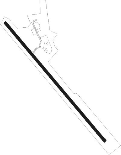
Runway info
| Runway 14 / 32 | ||
| length | 824m (2703ft) | |
| bearing | 136° / 316° | |
| width | 15m (50ft) | |
| surface | asphalt | |
| displ threshold | 61m (200ft) / 0m (0ft) | |
Nearby beacons
| code | identifier | dist | bearing | frequency |
|---|---|---|---|---|
| YK | CAGUR (YANKTON) NDB | 22.7 | 55° | 347 |
| YKN | YANKTON VOR/DME | 23.9 | 41° | 111.40 |
| OFK | NORFOLK VOR/DME | 37.2 | 158° | 109.60 |
| AGZ | WAGNER NDB | 39.6 | 308° | 392 |
| FS | ROKKY (SIOUX FALLS) NDB | 66.1 | 43° | 245 |
Disclaimer
The information on this website is not for real aviation. Use this data with the X-Plane flight simulator only! Data taken with kind consent from X-Plane 12 source code and data files. Content is subject to change without notice.