El Dorado - El Dorado Springs Mem
Airport details
| Country | United States of America |
| State | Missouri |
| Region | K3 |
| Airspace | Kansas City Ctr |
| Municipality | El Dorado Springs |
| Elevation | 931ft (284m) |
| Timezone | GMT -6 |
| Coordinates | 37.85714, -93.99764 |
| Magnetic var | |
| Type | land |
| Available since | X-Plane v10.40 |
| ICAO code | 87K |
| IATA code | n/a |
| FAA code | 87K |
Communication
| El Dorado Springs Mem CTAF/UNICOM | 122.800 |
Nearby Points of Interest:
Caplinger Mills Historic District
-Stockton Community Building
-Papinville Marais des Cygnes River Bridge
-Vernon County Jail, Sheriff's House and Office
-Vernon County Courthouse
-Infirmary Building, Missouri State Hospital Number 3
-George Dimmitt Memorial Hospital
-South Main Street Historic District
-Glasgow Commercial Historic District
-Harry S Truman Birthplace State Historic Site
-Greenfield Opera House
-Bates County Courthouse
-Golden Prairie
-Long Shoals Bridge
-Bolivar Public Library
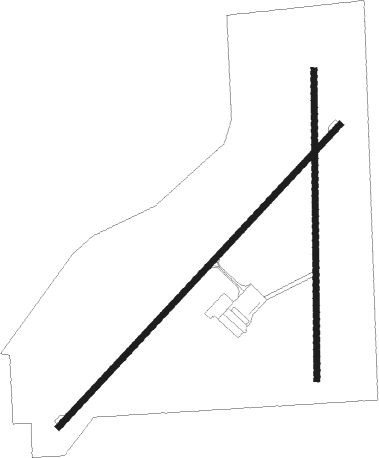
Runway info
Runway 4 / 22  | ||
| length | 1005m (3297ft) | |
| bearing | 54° / 234° | |
| width | 15m (50ft) | |
| surface | asphalt | |
| Runway 18 / 36 | ||
| length | 751m (2464ft) | |
| bearing | 185° / 5° | |
| width | 15m (50ft) | |
| surface | grass | |
Nearby beacons
| code | identifier | dist | bearing | frequency |
|---|---|---|---|---|
| BUM | BUTLER VORTAC | 34 | 310° | 115.90 |
| SGF | SPRINGFIELD VORTAC | 43.6 | 127° | 116.90 |
| JL | LUNNS (JOPLIN) NDB | 47.5 | 221° | 344 |
| SZL | WHITEMAN (KNOB NOSTER) TACAN | 56.8 | 27° | 109.80 |
| PK | HERBB (OLATHE) NDB | 64.1 | 320° | 420 |
Disclaimer
The information on this website is not for real aviation. Use this data with the X-Plane flight simulator only! Data taken with kind consent from X-Plane 12 source code and data files. Content is subject to change without notice.