Eureka
Airport details
| Country | United States of America |
| State | Montana |
| Region | K1 |
| Airspace | Seattle Ctr |
| Municipality | Lincoln County |
| Elevation | 2666ft (813m) |
| Timezone | GMT -7 |
| Coordinates | 48.96842, -115.07941 |
| Magnetic var | |
| Type | land |
| Available since | X-Plane v10.40 |
| ICAO code | 88M |
| IATA code | n/a |
| FAA code | n/a |
Communication
| EUREKA AWOS-AV | 118.375 |
| EUREKA CTAF | 122.900 |
Nearby Points of Interest:
Farmers and Merchants State Bank
-Hornet Lookout
-Kishenehn Ranger Station Historic District
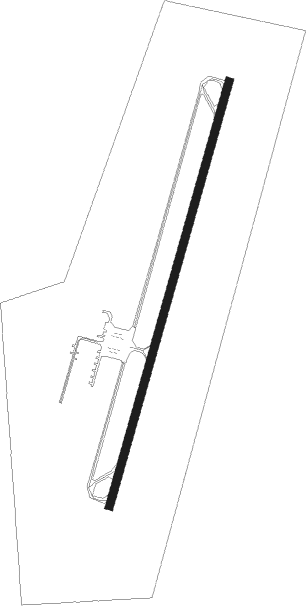
Runway info
| Runway 1 / 19 | ||
| length | 1281m (4203ft) | |
| bearing | 29° / 209° | |
| width | 23m (75ft) | |
| surface | asphalt | |
Nearby beacons
| code | identifier | dist | bearing | frequency |
|---|---|---|---|---|
| XC | CRANBROOK NDB | 50.9 | 315° | 242 |
| SAK | SMITH LAKE (KALISPELL) NDB | 57.2 | 144° | 515 |
| FCA | KALISPELL VOR/DME | 57.7 | 130° | 113.20 |
| SX | SKOOKUM (CRANBROOK) NDB | 65.4 | 324° | 368 |
Disclaimer
The information on this website is not for real aviation. Use this data with the X-Plane flight simulator only! Data taken with kind consent from X-Plane 12 source code and data files. Content is subject to change without notice.