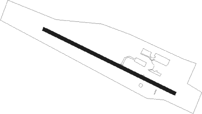
Eustis - Steven A Bean Muni
Airport details
| Country | United States of America |
| State | Maine |
| Region | K6 |
| Airspace | Boston Ctr |
| Municipality | Rangeley |
| Elevation | 1825ft (556m) |
| Timezone | GMT -5 |
| Coordinates | 44.99189, -70.66461 |
| Magnetic var | |
| Type | land |
| Available since | X-Plane v10.40 |
| ICAO code | 8B0 |
| IATA code | n/a |
| FAA code | n/a |
Communication
| Steven A Bean Muni AWOS 3 | 118.000 |
| Steven A Bean Muni CTAF/UNICOM | 122.800 |
Nearby Points of Interest:
Rangeley Public Library
-Rangeley Trust Company Building
-Upper Dallas School
-Coplin Plantation Schoolhouse
-Madrid Village Schoolhouse
-Ora Blanchard House
-Capt. Joel Whitney House
-Former Town House
-Forest Lodge
-Barn on Lot 8, Range G
-Weld Town Hall
-Frank Hutchins House
-William F. Norton House
-Andover Public Library
-Porter-Bell-Brackley Estate
-Upton Grange No. 404
-McCleary Farm
-New Portland Wire Bridge
-Deacon Hutchins House
-Rumford Public Library
-Rumford Municipal Building
-Rumford Falls Power Company Building
Runway info
| Runway 14 / 32 | ||
| length | 974m (3196ft) | |
| bearing | 113° / 293° | |
| width | 23m (75ft) | |
| surface | asphalt | |
Nearby beacons
| code | identifier | dist | bearing | frequency |
|---|---|---|---|---|
| RQM | RANGELEY NDB | 5 | 237° | 221 |
| BML | DME | 30.9 | 236° | 116.55 |
| AU | DUNNS (AUGUSTA) NDB | 48.9 | 126° | 366 |
| AUG | AUGUSTA VOR/DME | 54.8 | 128° | 114.95 |
| VLV | DME | 56.5 | 349° | 117.20 |
Instrument approach procedures
| runway | airway (heading) | route (dist, bearing) |
|---|---|---|
| RWNVD | AUG (308°) | AUG SHINY (57mi, 294°) 6000ft SHINY (turn) 6000ft |
| RNAV | SHINY 6000ft ZEMSI (10mi, 55°) 3800ft ROOTS (5mi, 56°) 2380ft (4592mi, 122°) 2380ft SHINY (4600mi, 302°) 6000ft SHINY (turn) 6000ft |
Disclaimer
The information on this website is not for real aviation. Use this data with the X-Plane flight simulator only! Data taken with kind consent from X-Plane 12 source code and data files. Content is subject to change without notice.
