Barre/barre Plains - Tanner-hiller
Airport details
| Country | United States of America |
| State | Massachusetts |
| Region | K6 |
| Airspace | Boston Ctr |
| Municipality | New Braintree |
| Elevation | 583ft (178m) |
| Timezone | GMT -5 |
| Coordinates | 42.35639, -72.13008 |
| Magnetic var | |
| Type | land |
| Available since | X-Plane v10.40 |
| ICAO code | 8B5 |
| IATA code | n/a |
| FAA code | n/a |
Communication
| Tanner-Hiller CTAF | 123.000 |
Nearby Points of Interest:
West Brick School
-Fobes-O'Donnell House
-Hardwick Village Historic District
-Barre Common District
-Gilbertville Historic District
-Wickaboag Valley Historic District
-North Brookfield Town House
-No. 4 Schoolhouse
-Gay Farm
-Old Indian Cemetery
-General Rufus Putnam House
-West Brookfield Center Historic District
-Otis Company Mill No. 1
-Ware Town Hall
-Barnes-Hill House
-District No. 5 School
-Camp Atwater
-District No. 4 School
-Moore State Park
-Petersham Common Historic District
-Pleasant Street School
-Prescott Town House
-Rev. Samuel Gay House
-Hubbardston Public Library
-Holland-Towne House
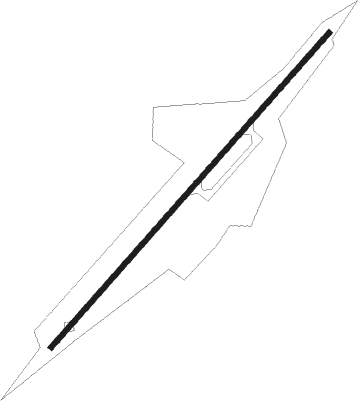
Runway info
| Runway 6 / 24 | ||
| length | 923m (3028ft) | |
| bearing | 54° / 234° | |
| width | 12m (40ft) | |
| surface | asphalt | |
| displ threshold | 46m (151ft) / 61m (200ft) | |
Nearby beacons
| code | identifier | dist | bearing | frequency |
|---|---|---|---|---|
| GDM | GARDNER VOR/DME | 11.8 | 21° | 110.60 |
| CEF | WESTOVER(SPRINGFIELD/CHIC TACAN | 20 | 248° | 114 |
| EEN | DME | 27.2 | 340° | 109.40 |
| PUT | PUTNAM VOR/DME | 27.2 | 144° | 117.40 |
| BAF | BARNES (WESTFIELD/SPRINGF VORTAC | 28.5 | 252° | 113 |
| CTR | CHESTER VOR/DME | 36.5 | 265° | 115.10 |
| MJ | FITZY (MANCHESTER) NDB | 40.4 | 50° | 209 |
| MHT | MANCHESTER VOR/DME | 45.5 | 56° | 114.40 |
| HFD | HARTFORD VOR/DME | 46.8 | 210° | 114.90 |
| ORW | NORWICH VOR/DME | 48.3 | 171° | 110 |
| PVD | PROVIDENCE VOR/DME | 49.1 | 132° | 115.60 |
| CO | EPSOM (CONCORD) NDB | 54.6 | 42° | 216 |
| CON | CONCORD VOR/DME | 57.3 | 33° | 112.90 |
Disclaimer
The information on this website is not for real aviation. Use this data with the X-Plane flight simulator only! Data taken with kind consent from X-Plane 12 source code and data files. Content is subject to change without notice.