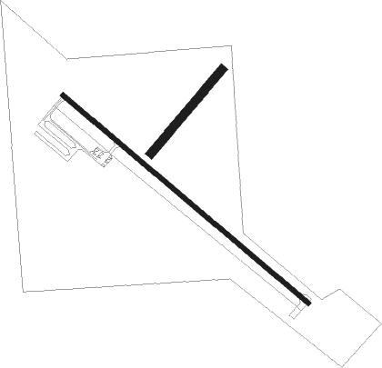
Clark - Clark County
Airport details
| Country | United States of America |
| State | South Dakota |
| Region | K3 |
| Airspace | Minneapolis Ctr |
| Municipality | Clark County |
| Elevation | 1791ft (546m) |
| Timezone | GMT -6 |
| Coordinates | 44.89503, -97.71048 |
| Magnetic var | |
| Type | land |
| Available since | X-Plane v10.40 |
| ICAO code | 8D7 |
| IATA code | n/a |
| FAA code | n/a |
Communication
| Clark County CTAF/UNICOM | 122.800 |
Nearby Points of Interest:
Codington County Courthouse
-Old Post Office
-Codington County Heritage Museum
-Evangelical United Brethren Church
-Dr. Tarbell House
-Corson Emminger Round Barn
-William Havens House
-Lars J. Fiksdal House
-Waddel Mansion
-First National Bank
-Anton and Mary Agnes Karpen House
-John and Kittie Williams House
Nearby beacons
| code | identifier | dist | bearing | frequency |
|---|---|---|---|---|
| ATY | WATERTOWN VORTAC | 24.7 | 82° | 116.60 |
| HON | DME | 37.4 | 233° | 117.60 |
| HO | BEADY (HURON) NDB | 38 | 234° | 302 |
| AB | RENEY (ABERDEEN) NDB | 39.4 | 308° | 203 |
| ABR | ABERDEEN VOR/DME | 41.9 | 308° | 113 |
| BK | CHRLZ (BROOKINGS) NDB | 46 | 125° | 335 |
Instrument approach procedures
| runway | airway (heading) | route (dist, bearing) |
|---|---|---|
| RW13 | WOPOB (125°) | WOPOB 3400ft |
| RNAV | WOPOB 3400ft IYLUG (5mi, 125°) 3400ft ZEVOB (2mi, 125°) 2780ft 8D7 (3mi, 125°) 1833ft (5733mi, 115°) 2193ft WUNOV (5726mi, 295°) 3400ft WUNOV (turn) | |
| RW31 | WUNOV (305°) | WUNOV 3400ft |
| RNAV | WUNOV 3400ft HOBUG (5mi, 305°) 3400ft WOLTA (3mi, 305°) 2460ft 8D7 (2mi, 306°) 1831ft (5733mi, 115°) 2193ft WOPOB (5739mi, 295°) 3400ft WOPOB (turn) |
Disclaimer
The information on this website is not for real aviation. Use this data with the X-Plane flight simulator only! Data taken with kind consent from X-Plane 12 source code and data files. Content is subject to change without notice.

