Fredericksburg - Carter Ranch
Airport details
| Country | United States of America |
| State | Texas |
| Region | |
| Airspace | Houston Oceanic Ctr |
| Municipality | Gillespie County |
| Elevation | 1837ft (560m) |
| Timezone | GMT -6 |
| Coordinates | 30.32164, -98.91431 |
| Magnetic var | |
| Type | land |
| Available since | X-Plane v10.40 |
| ICAO code | 8T7 |
| IATA code | n/a |
| FAA code | 8TE7 |
Communication
Nearby Points of Interest:
Fredericksburg Historic District
-Fredericksburg Memorial Library
-Frank Van Der Stucken Birthplace
-Hoerster Building
-HA. 19
-Wrede School
-Crabapple School
-Cherry Spring School
-Lyndon B. Johnson National Historical Park
-Reconstructed Birthplace
-Trinity Lutheran Church
-Pecan Creek School
-Williams Creek School
-Capt. Charles Schreiner Mansion
-Masonic Building
-Otto Brinkmann House
-Comfort Historic District
-Lyndon B. Johnson Boyhood Home
-Luckenbach School
-Old Camp Verde
-Llano County Courthouse and Jail
-Badu Building
-Mason Historic District
-Cave Without a Name
-Horseshoe Bay
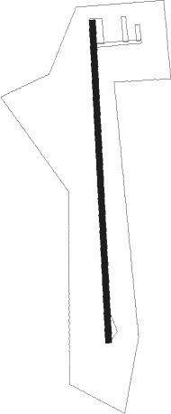
Runway info
| Runway 17 / 35 | ||
| length | 510m (1673ft) | |
| bearing | 182° / 2° | |
| width | 9m (30ft) | |
| surface | gravel | |
Nearby beacons
| code | identifier | dist | bearing | frequency |
|---|---|---|---|---|
| STV | STONEWALL VORTAC | 12.8 | 119° | 113.80 |
| CSI | CENTER POINT (KERRVILLE) VORTAC | 28.6 | 217° | 117.50 |
| LLO | LLANO VORTAC | 29.2 | 15° | 108.20 |
| AN | ALAMO (SAN ANTONIO) NDB | 46.4 | 154° | 368 |
| SAT | SAN ANTONIO VORTAC | 47 | 146° | 116.80 |
| JCT | JUNCTION VORTAC | 49.6 | 287° | 116 |
| RU | GARYS (AUSTIN) NDB | 54.6 | 111° | 272 |
| DHK | RANDOLPH TACAN | 57.9 | 141° | 109.90 |
| RND | RANDOLPH VORTAC | 58.2 | 142° | 112.30 |
| KSY | KELLY (SAN ANTONIO) TACAN | 58.4 | 160° | 112 |
| AGJ | GOOCH SPRINGS VORTAC | 65.4 | 42° | 112.50 |
Disclaimer
The information on this website is not for real aviation. Use this data with the X-Plane flight simulator only! Data taken with kind consent from X-Plane 12 source code and data files. Content is subject to change without notice.