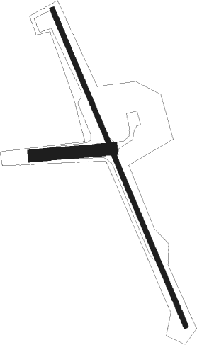
Bealeton - Hartwood
Airport details
| Country | United States of America |
| State | Virginia |
| Region | |
| Airspace | Washington Ctr |
| Municipality | Fauquier County |
| Elevation | 390ft (119m) |
| Timezone | GMT -5 |
| Coordinates | 38.48709, -77.61374 |
| Magnetic var | |
| Type | land |
| Available since | X-Plane v10.40 |
| ICAO code | 8W8 |
| IATA code | n/a |
| FAA code | n/a |
Communication
Nearby Points of Interest:
Hartwood Manor
-Casanova Historic District
-Catlett Historic District
-Auburn Battlefield
-Calverton Historic District
-Marine Corps Base Quantico
-Remington Historic District
-Pilgrim's Rest
-Effingham (Aden, Virginia)
-Germanna
-Stafford Training School
-Chopawamsic RDA Camp 2
-Public Quarry at Government Island
-Weston
-Fall Hill
-Gari Melchers Home
-Carlton (Falmouth, Virginia)
-Park Gate
-Bel-air
-Union Church and Cemetery
-Melrose (Casanova, Virginia)
-Clearview (Falmouth, Virginia)
-Conway House (Falmouth, Virginia)
-Battle of the Wilderness
-Elmhurst (Fredericksburg, Virginia)

Nearby beacons
| code | identifier | dist | bearing | frequency |
|---|---|---|---|---|
| MSQ | NAILR (CULPEPER) NDB | 13.8 | 264° | 351 |
| CSN | CASANOVA VORTAC | 15 | 301° | 116.30 |
| BRV | BROOKE VORTAC | 15.2 | 120° | 114.50 |
| EZF | SHANNON (FREDERICKSBURG) NDB | 15.3 | 144° | 237 |
| DAA | DAVEE (FT BELVOIR) NDB | 25.8 | 71° | 223 |
| AML | ARMEL (WASH.,D.C.) VOR/DME | 27.7 | 18° | 113.50 |
| DCA | OXONN (WASHINGTON) NDB | 32.2 | 65° | 332 |
| DCA | WASHINGTON, D.C. VOR/DME | 35.1 | 57° | 111 |
| GTN | GEORGETOWN (WASH., D.C.) NDB | 35.1 | 48° | 323 |
| LDN | LINDEN VORTAC | 35.4 | 302° | 114.30 |
| GVE | GORDONSVILLE VORTAC | 38.1 | 229° | 115.60 |
| ADW | ANDREWS (CAMP SPRINGS) VORTAC | 39.9 | 67° | 113.10 |
| LUA | CAVERNS (LURAY) NDB | 42.2 | 284° | 245 |
| OTT | NOTTINGHAM VORTAC | 42.8 | 76° | 113.70 |
| BUH | ANNE ARUNDEL (FT MEADE) NDB | 53.6 | 55° | 260 |
| MRB | MARTINSBURG VORTAC | 55 | 345° | 112.10 |
| FDK | FREDERICK VOR | 56.6 | 14° | 109 |
| FAK | FLAT ROCK VORTAC | 58.4 | 193° | 113.30 |
| BAL | BALTIMORE VORTAC | 60.6 | 54° | 115.10 |
| RIC | RICHMOND VORTAC | 60.7 | 163° | 114.10 |
| FND | ELLICOTT (BALTIMORE) NDB | 61.9 | 46° | 371 |
Disclaimer
The information on this website is not for real aviation. Use this data with the X-Plane flight simulator only! Data taken with kind consent from X-Plane 12 source code and data files. Content is subject to change without notice.