Potosi - Washington Co
Airport details
| Country | United States of America |
| State | Missouri |
| Region | K3 |
| Airspace | Kansas City Ctr |
| Municipality | Washington County |
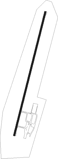
| Elevation | 958ft (292m) |
| Timezone | GMT -6 |
| Coordinates | 37.92920, -90.73148 |
| Magnetic var | |
| Type | land |
| Available since | X-Plane v10.40 |
| ICAO code | 8WC |
| IATA code | n/a |
| FAA code | n/a |
Communication
| Washington Co CTAF/UNICOM | 123.000 |
Nearby Points of Interest:
Washington County Courthouse
-Bonne Terre Depot
-Harrison Queen House
-Louis J. and Harriet Rozier House
-Central School Campus
-Presbyterian Orphanage of Missouri
-James Robinson McCormick House
-St. Francois County Jail and Sheriff's Residence
-Courthouse Square Historic District
-East Columbia Historic District
-Fort Davidson
-Immanuel Evangelical Lutheran Church (Pilot Knob, Missouri)
-Ironton Lodge Hall
-St. Paul's Episcopal Church
-Iron County Courthouse
-Panhorst Feed Store
-International Shoe Company Building
-Kolmer Site
-Fort de Chartres
-Stonebrook
-Valentine Leight General Store
-French Colonial Historic District
-Fredericktown Missouri Pacific Railroad Depot
-Madison County Courthouse
-Fredericktown Courthouse Square Historic District
Nearby beacons
| code | identifier | dist | bearing | frequency |
|---|---|---|---|---|
| FAM | FARMINGTON VORTAC | 28.1 | 117° | 115.70 |
| SU | SNOOP (ST LOUIS) NDB | 42.6 | 357° | 326 |
| FZ | EAVES (ST LOUIS) NDB | 45.7 | 14° | 227 |
| FTZ | FORISTELL VORTAC | 47.3 | 343° | 110.80 |
| CP | ACORE (CAHOKIA/ST LOUIS) NDB | 47.5 | 49° | 350 |
| VIH | VICHY (ROLLA/VICHY) VOR/DME | 48 | 283° | 117.70 |
| CSX | DME | 52.4 | 24° | 116.45 |
| SKE | SCOTT (BELLEVILLE) TACAN | 55.6 | 55° | 112.20 |
| STL | SAINT LOUIS VORTAC | 57.1 | 15° | 117.40 |
| JD | GOOEY (BELLEVILLE) NDB | 57.3 | 61° | 385 |
| TOY | TROY VORTAC | 61.9 | 45° | 116 |
| CVM | CIVIC MEMORIAL (ALTON) NDB | 65.9 | 35° | 263 |
Instrument approach procedures
| runway | airway (heading) | route (dist, bearing) |
|---|---|---|
| RW02 | BUNKS (51°) | BUNKS INUZA (17mi, 66°) 3200ft |
| RW02 | INUZA (23°) | INUZA 3200ft |
| RW02 | WOSGI (12°) | WOSGI INUZA (22mi, 7°) 3200ft |
| RNAV | INUZA 3200ft JINUX (5mi, 23°) 2600ft 8WC (5mi, 23°) 999ft (5440mi, 113°) 1359ft ZATUD (5436mi, 293°) 3100ft ZATUD (turn) | |
| RW20 | DELMA (139°) | DELMA JULMA (9mi, 79°) 3100ft ZATUD (5mi, 132°) 3100ft |
| RW20 | GLASS (244°) | GLASS ODPOE (10mi, 270°) 3100ft ZATUD (5mi, 261°) 3100ft |
| RW20 | IMPER (213°) | IMPER ZATUD (24mi, 217°) 3100ft |
| RW20 | ZATUD (203°) | ZATUD 3100ft |
| RNAV | ZATUD 3100ft RUNPE (6mi, 203°) 2600ft ZISAB (3mi, 203°) 1640ft 8WC (2mi, 203°) 986ft (5440mi, 113°) 1241ft INUZA (5443mi, 293°) 3200ft INUZA (turn) |
Disclaimer
The information on this website is not for real aviation. Use this data with the X-Plane flight simulator only! Data taken with kind consent from X-Plane 12 source code and data files. Content is subject to change without notice.