Prairie Du Sac - Sauk-prairie
Airport details
| Country | United States of America |
| State | Wisconsin |
| Region | |
| Airspace | Chicago Ctr |
| Municipality | Town of Prairie du Sac |
| Elevation | 832ft (254m) |
| Timezone | GMT -6 |
| Coordinates | 43.30188, -89.75608 |
| Magnetic var | |
| Type | land |
| Available since | X-Plane v10.40 |
| ICAO code | 91C |
| IATA code | n/a |
| FAA code | 91C |
Communication
| Sauk-Prairie CTAF | 122.900 |
| Sauk-Prairie Madison Appr | 135.450 |
| Sauk-Prairie Madison Dep | 135.450 |
Nearby Points of Interest:
Lachmund Family House
-Sauk City Fire Station
-Salem Evangelical Church
-Wisconsin Heights Battlefield
-John and Margarethe Kemp Cabin
-Merrimac Ferry
-Our Lady of Loretto Roman Catholic Church and Cemetery
-Mazomanie Downtown Historic District
-Ice Age Trail
-Point of Rocks
-Frederick Schumann Farmstead
-Baraboo Range
-John A. and Martha Robertson House
-Richard W. and Margaret Mills House
-Heiney's Meat Market
-Frank T. and Polly Lewis House
-Lodi Street-Prairie Street Historic District
-Daniel and Nellie Byrns House
-Joel M. Pruyn Block
-Job Mills Block
-Sauk County Courthouse
-Portage Street Historic District
-Clara F. Bacon House
-Walworth D. Porter Duplex Residence
-Durward's Glen
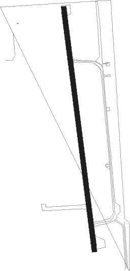
Runway info
| Runway 18 / 36 | ||
| length | 895m (2936ft) | |
| bearing | 176° / 356° | |
| width | 18m (60ft) | |
| surface | asphalt | |
Nearby beacons
| code | identifier | dist | bearing | frequency |
|---|---|---|---|---|
| DLL | DELLS (BARABOO) VORTAC | 14.9 | 358° | 117 |
| LNR | ROCK DME | 16.4 | 269° | 116.05 |
| MSN | MADISON VORTAC | 20.5 | 111° | 108.60 |
| VOK | VOLK (CAMP DOUGLAS) TACAN | 44.2 | 322° | 110.40 |
| DAF | NECEDAH NDB | 46.2 | 336° | 233 |
| JVL | JANESVILLE VOR/DME | 53 | 139° | 114.30 |
| CMY | MC COY NDB | 54.2 | 306° | 412 |
| DBQ | DUBUQUE VORTAC | 68.4 | 227° | 115.80 |
| DB | ZILOM (DUBUQUE) NDB | 69.5 | 221° | 341 |
Instrument approach procedures
| runway | airway (heading) | route (dist, bearing) |
|---|---|---|
| RW18 | DLL (178°) | DLL FOMAG (3mi, 186°) 3000ft |
| RW18 | FOMAG (176°) | FOMAG 3000ft |
| RW18 | JOOHR (82°) | JOOHR RAKME (28mi, 62°) 3000ft FOMAG (5mi, 88°) 3000ft |
| RW18 | MSN (291°) | MSN JABOL (25mi, 318°) 3300ft FOMAG (5mi, 268°) 3000ft |
| RW18 | RAKME (146°) | RAKME FOMAG (5mi, 88°) 3000ft |
| RNAV | FOMAG 3000ft HAPOX (6mi, 176°) 2500ft DIGPE (3mi, 176°) 1660ft 91C (3mi, 176°) 871ft (5395mi, 116°) 1232ft SOCNO (5394mi, 296°) 3200ft SOCNO (turn) | |
| RW36 | DLL (178°) | DLL SOCNO (27mi, 177°) 3200ft SOCNO (turn) 3200ft |
| RW36 | MSN (291°) | MSN KETME (13mi, 262°) 4800ft SOCNO (5mi, 268°) 3200ft |
| RW36 | ROODY (69°) | ROODY MOKRE (10mi, 117°) 3200ft SOCNO (5mi, 88°) 3200ft |
| RNAV | SOCNO 3200ft ANOXE (5mi, 356°) 2700ft OCARA (2mi, 356°) 2600ft BIKBE (3mi, 356°) 1640ft 91C (3mi, 356°) 860ft (5395mi, 116°) 1232ft FOMAG (5395mi, 296°) 3000ft FOMAG (turn) |
Disclaimer
The information on this website is not for real aviation. Use this data with the X-Plane flight simulator only! Data taken with kind consent from X-Plane 12 source code and data files. Content is subject to change without notice.