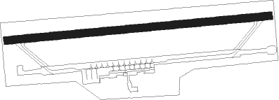
El Mirage - El Mirage Adelanto
Airport details
| Country | United States of America |
| State | California |
| Region | |
| Airspace | Los Angeles Ctr |
| Municipality | San Bernardino County |
| Elevation | 2865ft (873m) |
| Timezone | GMT -8 |
| Coordinates | 34.62529, -117.60896 |
| Magnetic var | |
| Type | land |
| Available since | X-Plane v10.40 |
| ICAO code | 99CL |
| IATA code | n/a |
| FAA code | 99CL |
Communication
| El Mirage Adelanto CTAF | 122.900 |
Nearby Points of Interest:
Rogers Dry Lake
-Sam and Alfreda Maloof Compound
-Gabrielino Trail
-Rubel Castle
-Cucamonga Service Station
-Old San Antonio Hospital
-Carnegie Library (Upland, California)
-Bono's Restaurant and Deli
-Russian Village District
-Ygnacio Palomares Adobe
Nearby beacons
| code | identifier | dist | bearing | frequency |
|---|---|---|---|---|
| VCV | VICTORVILLE VOR/DME | 10.9 | 98° | 109.05 |
| EDW | EDWARDS VORTAC | 22.2 | 341° | 116.40 |
| PMD | PALMDALE VORTAC | 22.4 | 271° | 114.50 |
| POM | POMONA VORTAC | 34 | 198° | 110.40 |
| SB | PETIS (SAN BERNARDINO) NDB | 36.2 | 157° | 397 |
| RAL | RIVERSIDE VOR | 41 | 167° | 112.40 |
| PDZ | PARADISE (ONTARIO) VORTAC | 42.6 | 174° | 112.20 |
| RIV | MARCH (RIVERSIDE) TACAN | 46.2 | 155° | 113 |
| LHS | LAKE HUGHES VORTAC | 47.9 | 273° | 114.35 |
| VNY | VAN NUYS VOR/DME | 49.9 | 246° | 113.10 |
| HDF | HOMELAND (RIVERSIDE) VOR | 55.1 | 153° | 113.40 |
| SLI | SEAL BEACH (LOS ALAMITOS) VORTAC | 55.2 | 208° | 115.70 |
| SMO | SANTA MONICA VOR/DME | 55.9 | 234° | 110.80 |
| ELB | EL TORO (SANTA ANA) VOR/DME | 57.3 | 187° | 117.20 |
| LAX | LOS ANGELES VORTAC | 58.2 | 230° | 113.60 |
Disclaimer
The information on this website is not for real aviation. Use this data with the X-Plane flight simulator only! Data taken with kind consent from X-Plane 12 source code and data files. Content is subject to change without notice.