Crawford
Airport details
| Country | United States of America |
| State | Colorado |
| Region | K2 |
| Airspace | Denver Ctr |
| Municipality | Delta County |
| Elevation | 6470ft (1972m) |
| Timezone | GMT -7 |
| Coordinates | 38.70415, -107.64367 |
| Magnetic var | |
| Type | land |
| Available since | X-Plane v11.50 |
| ICAO code | 99V |
| IATA code | n/a |
| FAA code | 99V |
Communication
| Crawford CTAF/UNICOM | 122.800 |
Nearby Points of Interest:
North Rim Road, Black Canyon of the Gunnison National Park
-North Rim Road
-Gunnison Tunnel
-D & RG Narrow Gauge Trestle
-Denver & Rio Grande Western Railroad Locomotive No. 278 and Tender
-Denver & Rio Grande Western Railroad Boxcar No. 3132
-Denver & Rio Grande Western Railroad Caboose No. 0577
-Denver & Rio Grande Western Railroad Stock Car No. 5679D
-Denver & Rio Grande Western Railroad Stock Car No. 5620
-Rio Grande Southern Railroad Derrick Car
-Denver & Rio Grande Railroad Box Outfit Car No. 04414
-First Presbyterian Church of Eckert
-U.S. Bureau of Reclamation Project Office Building
-Methodist Episcopal Church of Montrose
-Montrose Masonic Temple, Lodge No. 63
-Benevolent and Protective Order of Elks Lodge
-Montrose County Courthouse
-Sherman and Ross Block Building
-Thomas B. Townsend House
-Denver and Rio Grande Depot
-First Methodist Episcopal Church of Delta
-Delta County Bank Building
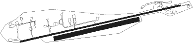
Runway info
Runway 7 / 25  | ||
| length | 1495m (4905ft) | |
| bearing | 83° / 263° | |
| width | 12m (40ft) | |
| surface | asphalt | |
| Runway 07R / 25L | ||
| length | 762m (2500ft) | |
| bearing | 83° / 263° | |
| width | 38m (125ft) | |
| surface | dirt | |
Nearby beacons
| code | identifier | dist | bearing | frequency |
|---|---|---|---|---|
| MTJ | MONTROSE VOR/DME | 16.8 | 232° | 117.10 |
| HBU | BLUE MESA (GUNNISON) VOR/DME | 32.1 | 113° | 114.90 |
| ETL | CONES (TELLURIDE) VOR/DME | 49.2 | 223° | 110.20 |
| RIL | RIFLE VOR/DME | 49.6 | 355° | 110.60 |
| DBL | RED TABLE (EAGLE) VOR/DME | 56.2 | 46° | 113 |
| SXW | SNOW (EAGLE) VOR/DME | 63.3 | 35° | 109.20 |
Disclaimer
The information on this website is not for real aviation. Use this data with the X-Plane flight simulator only! Data taken with kind consent from X-Plane 12 source code and data files. Content is subject to change without notice.