Marion - Shiflet Field
Airport details
| Country | United States of America |
| State | North Carolina |
| Region | |
| Airspace | Atlanta Ctr |
| Municipality | McDowell County |
| Elevation | 1209ft (369m) |
| Timezone | GMT -5 |
| Coordinates | 35.72143, -82.01560 |
| Magnetic var | |
| Type | land |
| Available since | X-Plane v10.40 |
| ICAO code | 9A9 |
| IATA code | n/a |
| FAA code | 9A9 |
Communication
Nearby Points of Interest:
First Presbyterian Church
-Main Street Historic District (Marion, North Carolina)
-McDowell County Courthouse
-St. Matthew's Lutheran Church
-Depot Historic District
-Church of the Resurrection
-Welsford Parker Artz House
-Old Fort Commercial Historic District
-Downtown Spruce Pine Historic District
-Mount Mitchell State Park
-Penland Post Office and General Store
-Quaker Meadows
-Bellevue
-Alphonse Calhoun Avery House
-Tate House
-Morganton Downtown Historic District
-Gaston Chapel
-Avery Avenue School
-Garrou-Morganton Full-Fashioned Hosiery Mills
-Rafael Guastavino, Sr., Estate
-Black Mountain Downtown Historic District
-Burke County Courthouse
-White Street-Valdese Avenue Historic District
-Broughton Hospital
-U. S. B. Dale's Market
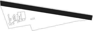
Runway info
| Runway 10 / 28 | ||
| length | 1044m (3425ft) | |
| bearing | 101° / 281° | |
| width | 55m (180ft) | |
| surface | grass | |
Nearby beacons
| code | identifier | dist | bearing | frequency |
|---|---|---|---|---|
| FIQ | FIDDLERS (MORGANTON) NDB | 16.7 | 92° | 391 |
| SUG | SUGARLOAF MT. (ASHEVILLE) VORTAC | 22.5 | 219° | 112.20 |
| BAR | HEMLOCK (BANNER ELK) NDB | 26.7 | 17° | 320 |
| IM | KEANS (ASHEVILLE) NDB | 30.1 | 252° | 357 |
| SLP | FIRST RIVER (SHELBY) NDB | 34.7 | 138° | 417 |
| HK | TAWBA (HICKORY) NDB | 34.8 | 85° | 332 |
| BRA | BROAD RIVER (ASHEVILLE) NDB | 34.9 | 225° | 379 |
| BZM | BARRETTS MOUNTAIN (HICKOR VOR/DME | 38.7 | 79° | 113.75 |
| SPA | SPARTANBURG VORTAC | 41.5 | 173° | 115.70 |
| JJC | MOUNTAIN CITY NDB | 42.7 | 15° | 396 |
| HMV | HOLSTON MOUNTAIN VORTAC | 43.3 | 351° | 114.60 |
| BO | BOOIE (BRISTOL) NDB | 46.8 | 325° | 221 |
| TR | MOCCA(BRISTOL-JOHNSON-KINGSPOR NDB | 52.1 | 340° | 299 |
| GHJ | STONIA (GASTONIA) NDB | 52.6 | 122° | 260 |
| JUH | ASHEE (JEFFERSON) NDB | 54.4 | 44° | 410 |
| GM | JUDKY (GREENVILLE) NDB | 58.8 | 200° | 521 |
| RVN | ROGERSVILLE NDB | 61 | 310° | 329 |
| UZ | RALLY (ROCK HILL) NDB | 67.7 | 132° | 227 |
| DCM | CHESTER NDB | 68.9 | 139° | 220 |
Disclaimer
The information on this website is not for real aviation. Use this data with the X-Plane flight simulator only! Data taken with kind consent from X-Plane 12 source code and data files. Content is subject to change without notice.