Marlborough - Salmon River Airfield
Airport details
| Country | United States of America |
| State | Connecticut |
| Region | |
| Airspace | Boston Ctr |
| Municipality | Marlborough |
| Elevation | 540ft (165m) |
| Timezone | GMT -5 |
| Coordinates | 41.59239, -72.44446 |
| Magnetic var | |
| Type | land |
| Available since | X-Plane v10.40 |
| ICAO code | 9B8 |
| IATA code | n/a |
| FAA code | 9B8 |
Communication
Nearby Points of Interest:
Rapallo Viaduct
-Lyman Viaduct
-Henry Champion House
-Old Bacon Academy
-Hebron Center Historic District
-Hayward House
-Wheeler Block
-Augustus Post House
-Amasa Day House
-Captain Enoch Lord House
-Wickham Road Historic District
-Daniel and Mary Lee House
-Little Haddam Historic District
-James Hazelton House
-East Haddam Historic District
-Connecticut Valley Hospital Cemetery
-Town Farms Inn
-Warner House
-Camp Bethel
-Marlborough Street Historic District
-Willimantic Elks Club
-Connecticut Valley Hospital
-Williams and Stancliff Octagon Houses
-Middletown Upper Houses Historic District
-Andover Center Historic District
Runway info
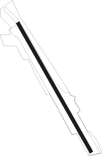
| Runway 17 / 35 | ||
| length | 756m (2480ft) | |
| bearing | 148° / 328° | |
| width | 18m (60ft) | |
| surface | grass | |
Nearby beacons
| code | identifier | dist | bearing | frequency |
|---|---|---|---|---|
| HFD | HARTFORD VOR/DME | 5.4 | 295° | 114.90 |
| MAD | MADISON VOR/DME | 20.1 | 222° | 110.40 |
| ORW | NORWICH VOR/DME | 20.1 | 95° | 110 |
| GON | GROTON VOR/DME | 23.6 | 124° | 110.85 |
| HVN | HAVEN DME | 28 | 233° | 109.80 |
| PUT | PUTNAM VOR/DME | 34.6 | 59° | 117.40 |
| BAF | BARNES (WESTFIELD/SPRINGF VORTAC | 36.3 | 334° | 113 |
| CEF | WESTOVER(SPRINGFIELD/CHIC TACAN | 36.5 | 352° | 114 |
| BDR | BRIDGEPORT VOR/DME | 40.1 | 238° | 108.80 |
| HTO | HAMPTON (EAST HAMPTON) VORTAC | 40.8 | 169° | 113.60 |
| CCC | CALVERTON VOR/DME | 42.8 | 208° | 117.20 |
| FOK | SUFFOLK CO (WESTHAMPTON B TACAN | 46.1 | 194° | 111 |
| SEY | SANDY POINT (BLOCK ISLAND VOR/DME | 46.7 | 116° | 117.80 |
| CTR | CHESTER VOR/DME | 47.6 | 324° | 115.10 |
| GDM | GARDNER VOR/DME | 59.7 | 22° | 110.60 |
| DPK | DEER PARK VOR/DME | 61.8 | 227° | 117.70 |
Disclaimer
The information on this website is not for real aviation. Use this data with the X-Plane flight simulator only! Data taken with kind consent from X-Plane 12 source code and data files. Content is subject to change without notice.