Sanger - Harris River Ranch
Airport details
| Country | United States of America |
| State | California |
| Region | K2 |
| Airspace | Oakland Ctr |
| Municipality | Fresno County |
| Elevation | 450ft (137m) |
| Timezone | GMT -8 |
| Coordinates | 36.77186, -119.44516 |
| Magnetic var | |
| Type | land |
| Available since | X-Plane v10.40 |
| ICAO code | 9CA7 |
| IATA code | n/a |
| FAA code | 9CA7 |
Communication
| HARRIS RIVER RANCH CTAF | 122.900 |
Nearby Points of Interest:
Orange Cove Santa Fe Railway Depot
-Fowler
-Orosi Branch Library
-Einstein House
-Southern Pacific Depot
-Fresno Bee Building
-San Joaquin Light and Power Corporation Building
-Bank of Italy
-Fort Miller
-Fresno Municipal Sanitary Landfill
-US Post Office-Visalia Town Center Station
-Hyde House (Visalia, California)
-Taoist Temple (Hanford, California)
-Kings County Courthouse
-The Pioneer
-Cabin Creek Ranger Residence and Dormitory
-Exeter Library
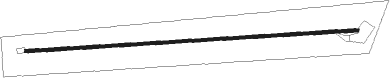
Runway info
| Runway 7 / 25 | ||
| length | 884m (2900ft) | |
| bearing | 91° / 271° | |
| width | 9m (28ft) | |
| surface | asphalt | |
Nearby beacons
| code | identifier | dist | bearing | frequency |
|---|---|---|---|---|
| CZQ | CLOVIS (FRESNO) VORTAC | 19 | 287° | 112.90 |
| FRA | FRIANT VORTAC | 21.2 | 336° | 115.60 |
| VIS | VISALIA VOR/DME | 24.3 | 185° | 109.40 |
| NLC | NAVY LEMOORE TACAN | 35.9 | 231° | 113.30 |
| HYP | EL NIDO (MERCED) VOR/DME | 53.1 | 295° | 114.20 |
| TTE | TULE VOR/DME | 55.5 | 154° | 109.20 |
Disclaimer
The information on this website is not for real aviation. Use this data with the X-Plane flight simulator only! Data taken with kind consent from X-Plane 12 source code and data files. Content is subject to change without notice.