Gregory - Gregory Muni - Flynn Fld
Airport details
| Country | United States of America |
| State | South Dakota |
| Region | K3 |
| Airspace | Minneapolis Ctr |
| Municipality | Gregory County |
| Elevation | 2166ft (660m) |
| Timezone | GMT -6 |
| Coordinates | 43.22178, -99.40342 |
| Magnetic var | |
| Type | land |
| Available since | X-Plane v10.40 |
| ICAO code | 9D1 |
| IATA code | n/a |
| FAA code | n/a |
Communication
| Gregory Muni - Flynn Fld CTAF/UNICOM | 122.800 |
Nearby Points of Interest:
St. Augustine Church
-Dallas Carnegie Library
-St. John's Catholic Church
-Herrick Elevator
-Church of Christ in LaRoche Township
-Carns State Aid Bridge
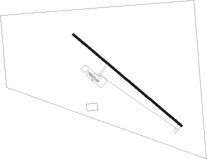
Runway info
| Runway 13 / 31 | ||
| length | 1159m (3802ft) | |
| bearing | 126° / 306° | |
| width | 18m (60ft) | |
| surface | asphalt | |
Nearby beacons
| code | identifier | dist | bearing | frequency |
|---|---|---|---|---|
| ANW | AINSWORTH VOR/DME | 46.9 | 222° | 112.70 |
| ONL | O'NEILL VORTAC | 55 | 136° | 113.90 |
Instrument approach procedures
| runway | airway (heading) | route (dist, bearing) |
|---|---|---|
| RW13 | HAIRY (126°) | HAIRY 4100ft |
| RW13 | LESNR (127°) | LESNR HAIRY (11mi, 128°) 4100ft |
| RW13 | LKOTA (93°) | LKOTA HAIRY (21mi, 78°) 4100ft |
| RNAV | HAIRY 4100ft VECLU (6mi, 126°) 3800ft 9D1 (5mi, 126°) 2210ft (5816mi, 113°) 2575ft ZAMSU (5808mi, 293°) 4000ft ZAMSU (turn) | |
| RW31 | NUKIY (338°) | NUKIY 4000ft ZAMSU (9mi, 32°) 4000ft |
| RW31 | WAPKU (282°) | WAPKU 4000ft ZAMSU (9mi, 251°) 4000ft |
| RW31 | ZAMSU (306°) | ZAMSU 4000ft |
| RNAV | ZAMSU 4000ft KIDKE (7mi, 306°) 3800ft SOLOY (3mi, 306°) 2900ft 9D1 (3mi, 306°) 2200ft (5816mi, 113°) 2480ft HAIRY (5823mi, 294°) 4100ft HAIRY (turn) |
Disclaimer
The information on this website is not for real aviation. Use this data with the X-Plane flight simulator only! Data taken with kind consent from X-Plane 12 source code and data files. Content is subject to change without notice.