Hastings
Airport details
| Country | United States of America |
| State | Michigan |
| Region | K5 |
| Airspace | Chicago Ctr |
| Municipality | Rutland Charter Township |
| Elevation | 798ft (243m) |
| Timezone | GMT -5 |
| Coordinates | 42.66355, -85.34621 |
| Magnetic var | |
| Type | land |
| Available since | X-Plane v10.40 |
| ICAO code | 9D9 |
| IATA code | n/a |
| FAA code | 9D9 |
Communication
| HASTINGS CTAF/UNICOM | 123.075 |
| HASTINGS GRAND RAPIDS Approach/Departure | 128.400 |
Nearby Points of Interest:
Barry County Courthouse
-Daniel Striker House
-Shriner-Ketcham House
-John Carveth House
-Austin H. and Frankie A. Dwight Summer House
-First Congregational Church
-Downtown Lowell Historic District
-North Country Trail
-Richland Historic District
-Island Historic District
-Richard and Mary Woodward Gregory House
-Roosevelt American Legion Hospital
-Sessions Schoolhouse
-American Seating Company Factory Complex
-Saint Joseph Seminary
-Division Avenue–Plaster Creek Bridge
-Advent Historic District
-Battle Creek Sanitarium
-Merritt Woods Historic District
-John W. Blodgett Estate
-Record Printing and Box Company Building
-Battle Creek Tower
-Mathias J. Alten House and Studio
-President Gerald R. Ford, Jr. Boyhood Home
-Michigan Central Railroad Depot
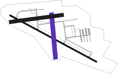
Runway info
Runway 12 / 30  | ||
| length | 1371m (4498ft) | |
| bearing | 115° / 295° | |
| width | 23m (75ft) | |
| surface | asphalt | |
| displ threshold | 77m (253ft) / 107m (351ft) | |
| Runway 18 / 36 | ||
| length | 595m (1952ft) | |
| bearing | 179° / 359° | |
| width | 61m (200ft) | |
| surface | grass | |
| Runway 09 / 27 | ||
| length | 723m (2372ft) | |
| bearing | 88° / 268° | |
| width | 52m (170ft) | |
| surface | grass | |
| displ threshold | 58m (190ft) / 114m (374ft) | |
Nearby beacons
| code | identifier | dist | bearing | frequency |
|---|---|---|---|---|
| VIO | VICTORY VOR/DME | 9.9 | 309° | 115.95 |
| GR | KNOBS (GRAND RAPIDS) NDB | 14 | 352° | 263 |
| BT | BATOL (BATTLE CREEK) NDB | 19.4 | 152° | 272 |
| AZO | KALAMAZOO VOR/DME | 27.2 | 206° | 109 |
| AZ | AUSTN (KALAMAZOO) NDB | 32.9 | 199° | 371 |
| PMM | PULLMAN VOR/DME | 35.5 | 255° | 112.10 |
| MKG | MUSKEGON TACAN | 43 | 306° | 115.20 |
| LFD | LITCHFIELD VOR/DME | 44.3 | 136° | 111.20 |
| JXN | DME | 46.2 | 114° | 115.45 |
| ELX | KEELER VOR/DME | 46.4 | 236° | 116.60 |
| IRS | STURGIS NDB | 51.2 | 186° | 382 |
| HIC | WHITE CLOUD VOR/DME | 57 | 338° | 117.60 |
| MOP | MOUNT PLEASANT VOR/DME | 63.4 | 32° | 110.60 |
| GIJ | GIPPER (NILES) VORTAC | 68.9 | 227° | 115.40 |
| SB | MISHA (SOUTH BEND) NDB | 69.4 | 222° | 341 |
Instrument approach procedures
| runway | airway (heading) | route (dist, bearing) |
|---|---|---|
| RW12 | BOHRR (50°) | BOHRR BLBBY (11mi, 326°) 3000ft BLBBY (turn) 3000ft |
| RW12 | JAKES (111°) | JAKES BLBBY (13mi, 107°) 3000ft |
| RW12 | UNSUN (252°) | UNSUN BLBBY (21mi, 271°) 3000ft BLBBY (turn) 3000ft |
| RNAV | BLBBY 3000ft AGEYU (6mi, 115°) 2300ft EDOGE (3mi, 115°) 1440ft 9D9 (2mi, 115°) 838ft (5200mi, 117°) 1087ft DERRE (5189mi, 297°) 3000ft DERRE (turn) | |
| RW30 | BOHRR (50°) | BOHRR DERRE (14mi, 96°) 3000ft DERRE (turn) 3000ft |
| RW30 | POSIE (290°) | POSIE DERRE (18mi, 286°) 3000ft |
| RNAV | DERRE 3000ft CADIM (7mi, 295°) 2300ft ECAVU (2mi, 295°) 1500ft 9D9 (3mi, 296°) 835ft (5200mi, 117°) 1400ft UNSUN (5188mi, 297°) 3000ft UNSUN (turn) |
Disclaimer
The information on this website is not for real aviation. Use this data with the X-Plane flight simulator only! Data taken with kind consent from X-Plane 12 source code and data files. Content is subject to change without notice.