Linden - Prices
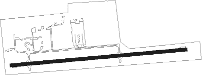
Airport details
| Country | United States of America |
| State | Michigan |
| Region | K5 |
| Airspace | Cleveland Ctr |
| Municipality | Genesee County |
| Elevation | 917ft (280m) |
| Timezone | GMT -5 |
| Coordinates | 42.80761, -83.76897 |
| Magnetic var | |
| Type | land |
| Available since | X-Plane v10.40 |
| ICAO code | 9G2 |
| IATA code | n/a |
| FAA code | 9G2 |
Communication
| Prices CTAF/UNICOM | 123.000 |
| Prices FLINT Approach/Departure | 128.550 |
| Prices FLINT Approach/Departure | 118.800 |
Nearby Points of Interest:
Bridge Street-Broad Street Historic District
-House at 7066 Lobdell Road
-James H. Murray House
-Dibbleville-Fentonville Historic District
-Fenton Railroad Depot
-Edwin Trump House
-William Henry and Lucinda McCaslin Farm House
-Jesse H. Buck Farm House
-Isaac R. Middlesworth Farm House
-Downtown Holly Commercial District
-Holly Union Depot
-Genesee Avenue–Walker Street Historic District
-Horace Gilbert House
-Highland United Methodist Church
-Flint Brewing Company Building
-Morris A. Knight House
-Robert P. Aitken Farm House
-Genesee County Courthouse
-Elks Lodge Building
-First Street Lofts
-Durant-Dort Carriage Company Office
-Genesee County Savings Bank
-Flint Journal Building
-Tinlinn Apartments
-Berridge Hotel
Nearby beacons
| code | identifier | dist | bearing | frequency |
|---|---|---|---|---|
| FNT | FLINT VORTAC | 9.6 | 8° | 116.90 |
| PSI | DME | 12.2 | 114° | 111 |
| SVM | SALEM VORTAC | 25.1 | 156° | 114.30 |
| DXO | DETROIT VOR/DME | 39.8 | 146° | 113.40 |
| MTC | SELFRIDGE (MOUNT CLEMENS) TACAN | 42.9 | 102° | 133.70 |
| DM | SPENC (DETROIT) NDB | 43.2 | 136° | 223 |
| MB | OLSTE (SAGINAW) NDB | 43.2 | 328° | 257 |
| DT | REVUP (DETROIT) NDB | 43.9 | 154° | 388 |
| JXN | DME | 44.8 | 232° | 115.45 |
| MBS | SAGINAW VOR/DME | 45.5 | 337° | 112.90 |
| TCU | TECUMSEH NDB | 46.7 | 189° | 239 |
| CRL | CARLETON VOR/DME | 47.6 | 158° | 115.70 |
| QG | WINDSOR NDB | 49.7 | 119° | 353 |
| RYS | GROSSE ILE (DETROIT) NDB | 50.4 | 139° | 419 |
| ADG | ADRIAN NDB | 57.9 | 198° | 278 |
| LFD | LITCHFIELD VOR/DME | 62.8 | 233° | 111.20 |
| MOP | MOUNT PLEASANT VOR/DME | 64.7 | 310° | 110.60 |
Instrument approach procedures
| runway | airway (heading) | route (dist, bearing) |
|---|---|---|
| RW09 | OQONI (89°) | OQONI 3100ft |
| RW09 | RUJVU (107°) | RUJVU 3100ft OQONI (5mi, 179°) 3100ft |
| RW09 | ULSOQ (72°) | ULSOQ 3100ft OQONI (5mi, 359°) 3100ft |
| RNAV | OQONI 3100ft IHUKU (6mi, 89°) 2600ft 9G2 (5mi, 89°) 959ft TUKJU (12mi, 90°) 2900ft TUKJU (turn) | |
| RW27 | OTCAK (287°) | OTCAK 2900ft TUKJU (5mi, 359°) 2900ft |
| RW27 | TUKJU (270°) | TUKJU 2900ft |
| RW27 | UBMOZ (252°) | UBMOZ 3100ft TUKJU (5mi, 179°) 2900ft |
| RNAV | TUKJU 2900ft EMQOP (6mi, 270°) 2700ft CELKA (3mi, 270°) 1580ft 9G2 (2mi, 269°) 951ft OQONI (11mi, 269°) 3100ft OQONI (turn) |
Disclaimer
The information on this website is not for real aviation. Use this data with the X-Plane flight simulator only! Data taken with kind consent from X-Plane 12 source code and data files. Content is subject to change without notice.