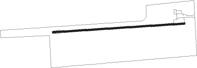
Albion - Pine Hill
Airport details
| Country | United States of America |
| State | New York |
| Region | |
| Airspace | Cleveland Ctr |
| Municipality | Town of Barre |
| Elevation | 666ft (203m) |
| Timezone | GMT -5 |
| Coordinates | 43.17358, -78.27964 |
| Magnetic var | |
| Type | land |
| Available since | X-Plane v10.40 |
| ICAO code | 9G6 |
| IATA code | n/a |
| FAA code | 9G6 |
Communication
Nearby Points of Interest:
Benjamin Franklin Gates House
-Skinner-Tinkham House
-Oak Orchard Creek
-William V. N. Barlow House
-Main Street Historic District
-United States Post Office
-Medina Armory
-Orleans County Courthouse Historic District
-North Main–Bank Streets Historic District
-Tousley-Church House
-Boxwood Cemetery
-Bacon–Harding Farm
-Servoss House
-Cobblestone Historic District
-John Shelp Cobblestone House
-William Taylor House
-Clarendon Stone Store
-Jackson Blood Cobblestone House
-Mount Pleasant
-Batavia Veterans Administration Hospital
-Constant Riley W. Bixby House
-District 10 Schoolhouse
-Genesee County Courthouse Historic District
Nearby beacons
| code | identifier | dist | bearing | frequency |
|---|---|---|---|---|
| BU | KLUMP (BUFFALO) NDB | 19.3 | 245° | 231 |
| BUF | BUFFALO VOR/DME | 21.7 | 236° | 116.40 |
| IA | KATHI (NIAGRA FALLS) NDB | 24.7 | 263° | 329 |
| ROC | ROCHESTER VOR/DME | 26.8 | 95° | 110 |
| GB | PLAZZ (BUFFALO) NDB | 29.6 | 241° | 204 |
| IAG | NIAGARA FALLS TACAN | 30 | 265° | 111 |
| GEE | GENESEO VOR/DME | 31.4 | 122° | 108.20 |
| SN | ST CATHARINES NDB | 42.7 | 268° | 408 |
| YO | DME-ILS | 51.9 | 321° | 111.35 |
| OO | OSHAWA NDB | 52.3 | 320° | 391 |
| ZZR | SEVERN (TRENTON) NDB | 59.9 | 37° | 317 |
| DKK | DME | 60 | 236° | 116.20 |
| UTR | TRENTON TACAN | 65.6 | 38° | 109.70 |
| JHW | JAMESTOWN VOR/DME | 69.8 | 221° | 114.70 |
Instrument approach procedures
| runway | airway (heading) | route (dist, bearing) |
|---|---|---|
| RWNVB | BUF (56°) | BUF LEGGY (10mi, 57°) 3300ft |
| RWNVB | CLUNG (293°) | CLUNG LEGGY (21mi, 268°) 3300ft LEGGY (turn) 3300ft |
| RNAV | LEGGY 3300ft HEDSI (6mi, 57°) 2400ft EYEVU (6mi, 57°) 1360ft (4893mi, 119°) 1360ft LEGGY (4901mi, 299°) 3300ft LEGGY (turn) |
Disclaimer
The information on this website is not for real aviation. Use this data with the X-Plane flight simulator only! Data taken with kind consent from X-Plane 12 source code and data files. Content is subject to change without notice.