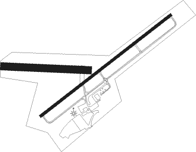
Revloc - Ebensburg
Airport details
| Country | United States of America |
| State | Pennsylvania |
| Region | K6 |
| Airspace | Cleveland Ctr |
| Municipality | Cambria Township |
| Elevation | 2099ft (640m) |
| Timezone | GMT -5 |
| Coordinates | 40.46121, -78.77525 |
| Magnetic var | |
| Type | land |
| Available since | X-Plane v10.40 |
| ICAO code | 9G8 |
| IATA code | n/a |
| FAA code | n/a |
Communication
| EBENSBURG CTAF/UNICOM | 122.800 |
| EBENSBURG JOHNSTOWN Departure | 135.975 |
| EBENSBURG CLEVELAND CNTR | 121.200 |
| EBENSBURG JOHNSTOWN Approach | 135.975 |
Nearby Points of Interest:
Berwind-White Mine 40 Historic District
-Revloc Historic District
-Cambria County Courthouse
-Philip Noon House
-A.W. Buck House
-Colver Historic District
-Portage Historic District
-Ghost Town Trail
-Staple Bend Tunnel
-Bridge in Portage Township
-South Fork Fishing and Hunting Club Clubhouse
-Benjamin Franklin Jones Cottage
-Cambria Iron Company
-Old Conemaugh Borough Historic District
-Cathedral of Saint John Gualbert
-Grand Army of the Republic Hall
-Nathan's Department Store
-Downtown Johnstown Historic District
-Inclined Plane Bridge
-Johnstown Inclined Plane
-Westmont Historic District
-Moxham Historic District
-Patton Historic District
-George Diehl Homestead
-Windber Historic District
Nearby beacons
| code | identifier | dist | bearing | frequency |
|---|---|---|---|---|
| REC | REVLOC VOR/DME | 5.2 | 18° | 110.60 |
| JST | JOHNSTOWN VOR/DME | 9 | 202° | 113 |
| SYS | STOYSTOWN (SOMERSET) NDB | 23.4 | 201° | 209 |
| IHD | INDIAN HEAD VORTAC | 39.6 | 230° | 108.20 |
| PSB | PHILIPSBURG VORTAC | 44.9 | 60° | 115.50 |
| THS | SAINT THOMAS VORTAC | 49.3 | 123° | 115 |
| GRV | DME | 51.2 | 198° | 112.30 |
| CIP | DME | 51.5 | 315° | 112.90 |
| ETG | KEATING VORTAC | 53.6 | 40° | 116 |
| VV | CAMOR (CONNELLSVILLE) NDB | 56.4 | 239° | 299 |
| HGR | HAGERSTOWN VOR | 62.3 | 130° | 109.80 |
Instrument approach procedures
| runway | airway (heading) | route (dist, bearing) |
|---|---|---|
| RW07 | JST (22°) | JST BLAYR (7mi, 284°) 4400ft BLAYR (turn) 4400ft |
| RW07 | REC (198°) | REC BLAYR (16mi, 231°) 4400ft BLAYR (turn) 4400ft |
| RNAV | BLAYR 4400ft ALLAC (6mi, 63°) 3800ft CHIMS (3mi, 63°) 2740ft 9G8 (2mi, 62°) 2600ft (4894mi, 117°) 2600ft BLAYR (4902mi, 297°) 4400ft BLAYR (turn) | |
| RW25 | JST (22°) | JST EXPYR (20mi, 48°) 4100ft EXPYR (turn) 4100ft |
| RW25 | REC (198°) | REC EXPYR (9mi, 83°) 4100ft EXPYR (turn) 4100ft |
| RNAV | EXPYR 4100ft DEZZZ (6mi, 243°) 3900ft FANDA (4mi, 243°) 2720ft 9G8 (2mi, 244°) 2148ft (4894mi, 117°) 2499ft EXPYR (4885mi, 297°) 4100ft EXPYR (turn) |
Disclaimer
The information on this website is not for real aviation. Use this data with the X-Plane flight simulator only! Data taken with kind consent from X-Plane 12 source code and data files. Content is subject to change without notice.

