Collierville - Vetters Sky Ranch
Airport details
| Country | United States of America |
| State | California |
| Region | |
| Airspace | Oakland Ctr |
| Municipality | San Joaquin County |
| Elevation | 80ft (24m) |
| Timezone | GMT -8 |
| Coordinates | 38.23007, -121.22593 |
| Magnetic var | |
| Type | land |
| Available since | X-Plane v10.40 |
| ICAO code | 9Q3 |
| IATA code | n/a |
| FAA code | n/a |
Communication
Nearby Points of Interest:
Brewster House
-Harmony Grove Church
-I.O.O.F. Hall
-Woodbridge Masonic Lodge No. 131
-Lodi Arch
-Woman's Club of Lodi
-Brewster Building
-Alta Mesa Farm Bureau Hall
-Cosumnes River Preserve
-Scully Ranch
-Elks Building
-Rosebud Ranch
-United States Post Office (Stockton, California)
-Tretheway Block
-Wong K. Gew Mansion
-Isleton Chinese and Japanese Commercial Districts
-Brighton School
-SMUD Headquarters Building
-Dunlap's Dining Room
-American River Grange Hall No. 172
-Fire Station No. 6
-J. C. Carly House
-Jackson Downtown Historic District
-Julia Morgan House
-Kennedy Mine
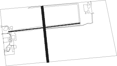
Runway info
Runway 9 / 27  | ||
| length | 629m (2064ft) | |
| bearing | 88° / 268° | |
| width | 5m (16ft) | |
| surface | asphalt | |
| Runway 17 / 35 | ||
| length | 479m (1572ft) | |
| bearing | 178° / 358° | |
| width | 20m (66ft) | |
| surface | dirt | |
Nearby beacons
| code | identifier | dist | bearing | frequency |
|---|---|---|---|---|
| LIN | LINDEN VOR/DME | 14 | 125° | 114.80 |
| SAC | SACRAMENTO VORTAC | 20 | 303° | 115.20 |
| MCC | MC CLELLAN (SACRAMENTO) VOR/DME | 27.5 | 338° | 109.20 |
| SUU | TRAVIS (FAIRFIELD) TACAN | 33.9 | 271° | 116.60 |
| HNW | HANGTOWN (PLACERVILLE) VOR/DME | 37.2 | 44° | 115.50 |
| MOD | MODESTO VOR/DME | 38.3 | 156° | 114.60 |
| LV | REIGA (LIVERMORE) NDB | 38.9 | 220° | 374 |
| CCR | CONCORD VOR/DME | 40.2 | 257° | 117 |
| MYV | MARYSVILLE VOR/DME | 54.6 | 338° | 110.80 |
| BAB | BEALE (MARYSVILLE) TACAN | 55.2 | 347° | 108.60 |
| OAK | OAKLAND VOR/DME | 56.1 | 243° | 116.80 |
| SJC | SAN JOSE VOR/DME | 61.6 | 220° | 114.10 |
| NUQ | MOFFETT (MOUNTAIN VIEW) TACAN | 62 | 226° | 117.60 |
| ILA | WILLIAMS VORTAC | 62.9 | 316° | 114.40 |
| SWR | SQUAW VALLEY(SOUTH LAKE T VOR/DME | 72.5 | 45° | 113.20 |
Disclaimer
The information on this website is not for real aviation. Use this data with the X-Plane flight simulator only! Data taken with kind consent from X-Plane 12 source code and data files. Content is subject to change without notice.