Scobey
Airport details
| Country | United States of America |
| State | Montana |
| Region | K1 |
| Airspace | Salt Lake City Ctr |
| Municipality | Daniels County |
| Elevation | 2432ft (741m) |
| Timezone | GMT -7 |
| Coordinates | 48.80772, -105.43948 |
| Magnetic var | |
| Type | land |
| Available since | X-Plane v10.40 |
| ICAO code | 9S2 |
| IATA code | n/a |
| FAA code | n/a |
Communication
| SCOBEY CTAF/UNICOM | 122.800 |
| SCOBEY SALT LAKE CITY Approach | 126.850 |
| SCOBEY SALT LAKE CITY Departure | 126.850 |
Nearby Points of Interest:
Daniels County Courthouse
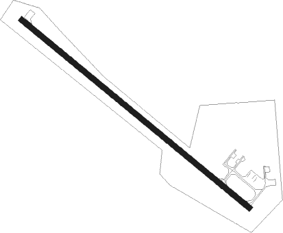
Runway info
| Runway 12 / 30 | ||
| length | 1223m (4012ft) | |
| bearing | 122° / 302° | |
| width | 23m (75ft) | |
| surface | asphalt | |
Nearby beacons
| code | identifier | dist | bearing | frequency |
|---|---|---|---|---|
| NI | ASSINIBOIA NDB | 58.7 | 331° | 278 |
Instrument approach procedures
| runway | airway (heading) | route (dist, bearing) |
|---|---|---|
| RW12 | GGW (63°) | GGW NIJBU (53mi, 55°) 6000ft GEMPE (5mi, 55°) 4500ft |
| RW12 | ISN (288°) | ISN ROGUU (76mi, 285°) 6000ft NIJBU (10mi, 302°) 6000ft GEMPE (5mi, 55°) 4500ft |
| RNAV | GEMPE 4500ft DOGNE (5mi, 122°) 3700ft 9S2 (4mi, 122°) 2430ft (6012mi, 115°) 3600ft NIJBU (6021mi, 295°) 6000ft NIJBU (turn) |
Disclaimer
The information on this website is not for real aviation. Use this data with the X-Plane flight simulator only! Data taken with kind consent from X-Plane 12 source code and data files. Content is subject to change without notice.