Three Forks
Airport details
| Country | United States of America |
| State | Montana |
| Region | K1 |
| Airspace | Salt Lake City Ctr |
| Municipality | Three Forks |
| Elevation | 4086ft (1245m) |
| Timezone | GMT -7 |
| Coordinates | 45.87811, -111.56944 |
| Magnetic var | |
| Type | land |
| Available since | X-Plane v10.40 |
| ICAO code | 9S5 |
| IATA code | n/a |
| FAA code | 9S5 |
Communication
| Three Forks CTAF/UNICOM | 122.800 |
Nearby Points of Interest:
Adams Block
-Missouri Headwaters State Park
-Belgrade City Hall and Jail
-Bon Ton Historic District
-Gallatin County Courthouse
-Gallatin County High School
-Charles Lundwall Building
-Beall Park Community Center
-R.T. Barnett and Company Building
-Bozeman Carnegie Library
-Spieth and Krug Brewery
-Bohart House
-Samuel Lewis House
-State Bank of Townsend
-Bozeman National Fish Hatchery
-Eagle Guard Station
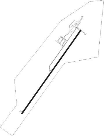
Runway info
| Runway 3 / 21 | ||
| length | 1554m (5098ft) | |
| bearing | 50° / 230° | |
| width | 18m (60ft) | |
| surface | asphalt | |
Nearby beacons
| code | identifier | dist | bearing | frequency |
|---|---|---|---|---|
| BZ | MANNI (BOZEMAN) NDB | 11.8 | 91° | 266 |
| BZN | BOZEMAN VOR/DME | 18.2 | 103° | 112.40 |
| HIA | WHITEHALL VOR/DME | 25.1 | 268° | 113.70 |
| EKS | ENNIS NDB | 36.8 | 188° | 286 |
| HAU | HAUSER (HELENA) NDB | 42.2 | 345° | 386 |
| HLN | HELENA VORTAC | 46.5 | 332° | 117.70 |
| DLN | DILLON VOR/DME | 55.8 | 237° | 113 |
Disclaimer
The information on this website is not for real aviation. Use this data with the X-Plane flight simulator only! Data taken with kind consent from X-Plane 12 source code and data files. Content is subject to change without notice.