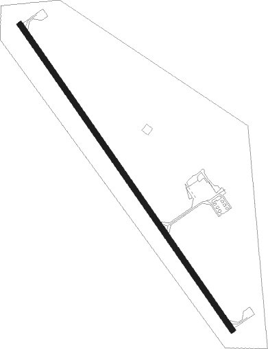
Rushville - Modisett
Airport details
| Country | United States of America |
| State | Nebraska |
| Region | K3 |
| Airspace | Denver Ctr |
| Municipality | Sheridan County |
| Elevation | 3750ft (1143m) |
| Timezone | GMT -7 |
| Coordinates | 42.73658, -102.44436 |
| Magnetic var | |
| Type | land |
| Available since | X-Plane v10.40 |
| ICAO code | 9V5 |
| IATA code | n/a |
| FAA code | 9V5 |
Communication
| Modisett CTAF | 122.900 |
Nearby Points of Interest:
Plains Theatre
-Sheridan County Courthouse
-Lee and Gottliebe Fritz House
-Wounded Knee Battlefield
-Sparks Hall
-Crites Hall
-Chadron Public Library
-Edna Work Hall
-Miller Hall
Nearby beacons
| code | identifier | dist | bearing | frequency |
|---|---|---|---|---|
| GRN | GORDON NDB | 12.3 | 76° | 414 |
| HIN | WHITNEY (CHADRON) NDB | 29.1 | 278° | 275 |
| CD | DAWES (CHADRON) NDB | 32.2 | 271° | 362 |
| TST | TOADSTOOL VOR/DME | 39.7 | 258° | 113.40 |
| AIA | ALLIANCE VOR/DME | 43.9 | 208° | 111.80 |
Instrument approach procedures
| runway | airway (heading) | route (dist, bearing) |
|---|---|---|
| RW14 | FIYCA (171°) | FIYCA 6000ft HEDLA (5mi, 247°) 6000ft |
| RW14 | GIZAB (118°) | GIZAB 6000ft HEDLA (5mi, 67°) 6000ft |
| RW14 | HEDLA (141°) | HEDLA 6000ft |
| RNAV | HEDLA 6000ft FINIB (6mi, 141°) 5400ft GOCRU (3mi, 141°) 4480ft 9V5 (3mi, 142°) 3789ft AYEVA (11mi, 142°) 6000ft AYEVA (turn) | |
| RW32 | AYEVA (322°) | AYEVA 6000ft |
| RW32 | COCHU (351°) | COCHU 6000ft AYEVA (5mi, 67°) 6000ft |
| RW32 | EHFAD (298°) | EHFAD 6000ft AYEVA (5mi, 247°) 6000ft |
| RNAV | AYEVA 6000ft ATETE (6mi, 322°) 5400ft CIDUD (3mi, 322°) 4420ft 9V5 (2mi, 322°) 3791ft HEDLA (11mi, 321°) 6000ft HEDLA (turn) |
Disclaimer
The information on this website is not for real aviation. Use this data with the X-Plane flight simulator only! Data taken with kind consent from X-Plane 12 source code and data files. Content is subject to change without notice.
