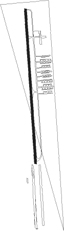
Porter Heights - North Houston
Airport details
| Country | United States of America |
| State | Texas |
| Region | K4 |
| Airspace | Houston Oceanic Ctr |
| Municipality | Montgomery County |
| Elevation | 125ft (38m) |
| Timezone | GMT -6 |
| Coordinates | 30.15338, -95.32199 |
| Magnetic var | |
| Type | land |
| Available since | X-Plane v10.40 |
| ICAO code | 9X1 |
| IATA code | n/a |
| FAA code | n/a |
Communication
| North Houston CTAF/UNICOM | 122.800 |
Nearby Points of Interest:
Ben C. and Jenetter Cyrus House
-Charles Johnson House
-Oscar Lindsay House
-Allbach House
-Houston Heights Woman's Club
-Banta House
-Houston Heights Waterworks Reservoir
-Burge House
-Barker House
-David A. Carden House
-Gillette House
-Houston Heights Fire Station
-Webber House
-Otto H. Baring House
-All Saints Catholic Church
-John W. Anderson House
-Isbell House
-James Bute Company Warehouse
-McKee Street Bridge
-Heights State Bank Building
-Merchants and Manufacturers Building
-San Jacinto Street Bridge over Buffalo Bayou
-Houston Cotton Exchange Building
-1879 Houston Waterworks
-W. L. Foley Building
Nearby beacons
| code | identifier | dist | bearing | frequency |
|---|---|---|---|---|
| BVP | NIXIN (HOUSTON) NDB | 11.1 | 146° | 326 |
| IAH | HUMBLE (HOUSTON) VORTAC | 11.8 | 187° | 116.60 |
| CX | ALIBI (HOUSTON) NDB | 18.5 | 331° | 281 |
| EFD | ELLINGTON (HOUSTON) TACAN | 33.9 | 163° | 109.40 |
| DAS | DAISETTA VORTAC | 35.2 | 87° | 116.90 |
| UTS | HUNTSVILLE NDB | 37.9 | 335° | 308 |
| TNV | NAVASOTA VOR/DME | 39 | 280° | 115.90 |
| MHF | TRINITY (SMITH POINT) VOR/DME | 47.1 | 137° | 113.60 |
| VUH | SCHOLES (GALVESTON) VOR/DME | 58.1 | 153° | 113 |
| ELA | EAGLE LAKE VOR/DME | 59.6 | 244° | 116.40 |
| LOA | LEONA VORTAC | 67.1 | 326° | 110.80 |
Disclaimer
The information on this website is not for real aviation. Use this data with the X-Plane flight simulator only! Data taken with kind consent from X-Plane 12 source code and data files. Content is subject to change without notice.