Elbert - Colorado Springs East
Airport details
| Country | United States of America |
| State | Colorado |
| Region | K2 |
| Airspace | Denver Ctr |
| Municipality | El Paso County |
| Elevation | 6145ft (1873m) |
| Timezone | GMT -7 |
| Coordinates | 38.87425, -104.40984 |
| Magnetic var | |
| Type | land |
| Available since | X-Plane v10.40 |
| ICAO code | A50 |
| IATA code | n/a |
| FAA code | CO49 |
Communication
| Colorado Springs East CTAF | 122.900 |
Nearby Points of Interest:
Drennan School
-Black Squirrel Creek Bridge
-Calhan Paint Mines Archeological District
-Calhan Rock Island Railroad Depot
-Black Forest School
-Taylor Memorial Chapel
-S. A. Wilson Elementary School
-J.G. Evans Barn
-Old Livery Stable
-First Presbyterian Church of Ramah
-Cottonwood Creek Bridge
-Santa Fe Depot
-Lennox House
-Edgeplain
-Burgess House
-United States Post Office and Federal Courthouse-Colorado Springs Main
-Ida M. Rice House
-Gwynne–Love House
-DeGraff Building
-Montgomery Hall, Colorado College
-Judson Moss Bemis House
-Bemis Hall
-Frederick H. Cossitt Memorial Hall
-Hagerman Mansion
-Colorado Springs Day Nursery
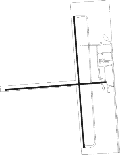
Runway info
Runway 17 / 35  | ||
| length | 1373m (4505ft) | |
| bearing | 180° / 0° | |
| width | 13m (42ft) | |
| surface | asphalt | |
| Runway 08 / 26 | ||
| length | 1054m (3458ft) | |
| bearing | 90° / 270° | |
| width | 15m (49ft) | |
| surface | gravel | |
Nearby beacons
| code | identifier | dist | bearing | frequency |
|---|---|---|---|---|
| BRK | BLACK FOREST VOR/DME | 11.2 | 287° | 112.50 |
| CO | PETEY (COLORADO SPRINGS) NDB | 17.9 | 240° | 407 |
| FCS | BUTTS (FORT CARSON) VOR/DME | 19.9 | 241° | 108.80 |
| IHS | IRONHORSE (FORT CARSON) NDB | 19.9 | 240° | 335 |
| PUB | PUEBLO VORTAC | 34.8 | 182° | 116.70 |
| TF | ARUBA (PUEBLO) NDB | 35.1 | 175° | 373 |
| HGO | HUGO VOR/DME | 37 | 94° | 112.10 |
| FQF | FALCON (DENVER) VORTAC | 49.9 | 345° | 116.30 |
| BKF | BUCKLEY (AURORA) TACAN | 52.5 | 338° | 109.60 |
| DEN | DENVER VOR/DME | 57.5 | 345° | 117.90 |
Disclaimer
The information on this website is not for real aviation. Use this data with the X-Plane flight simulator only! Data taken with kind consent from X-Plane 12 source code and data files. Content is subject to change without notice.