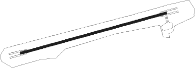
Munda
Airport details
| Country | Solomon Islands |
| State | Western |
| Region | AG |
| Airspace | Honiara Ctr |
| Elevation | 14ft (4m) |
| Timezone | GMT +11 |
| Coordinates | -8.32000, 157.26167 |
| Magnetic var | |
| Type | land |
| Available since | X-Plane v10.40 |
| ICAO code | AGGM |
| IATA code | MUA |
| FAA code | n/a |
Communication
Nearby beacons
| code | identifier | dist | bearing | frequency |
|---|---|---|---|---|
| MUD | MUNDA NDB | 0.7 | 211° | 400 |
Instrument approach procedures
| runway | airway (heading) | route (dist, bearing) |
|---|---|---|
| RW07 | KILAM (82°) | KILAM 2500ft |
| RW07 | LAKAS (101°) | LAKAS KILAM (5mi, 155°) 2500ft |
| RW07 | MUNOS (63°) | MUNOS KILAM (5mi, 15°) 2500ft |
| RNAV | KILAM 2500ft GM868 (5mi, 85°) 2000ft MA07 (5mi, 85°) 477ft KILAM (10mi, 265°) 2500ft | |
| RW25 | GOMEN (261°) | GOMEN 3600ft |
| RW25 | KAKUS (279°) | KAKUS GOMEN (5mi, 329°) 3000ft |
| RW25 | LAVEM (242°) | LAVEM GOMEN (5mi, 189°) 3000ft |
| RNAV | GOMEN 3000ft GM823 (5mi, 259°) 2420ft MA25 (5mi, 259°) 666ft (9363mi, 273°) 1500ft GOMEN (9373mi, 93°) 3600ft |
Disclaimer
The information on this website is not for real aviation. Use this data with the X-Plane flight simulator only! Data taken with kind consent from X-Plane 12 source code and data files. Content is subject to change without notice.
