Palmer - Sky Ranch At Pioneer Peak
Airport details
| Country | United States of America |
| State | Alaska |
| Region | |
| Municipality | Matanuska-Susitna |
| Elevation | 120ft (37m) |
| Timezone | GMT -9 |
| Coordinates | 61.55465, -149.14711 |
| Magnetic var | |
| Type | land |
| Available since | X-Plane v10.40 |
| ICAO code | AK50 |
| IATA code | n/a |
| FAA code | AK50 |
Communication
Nearby Points of Interest:
Campbell House
-Raymond Rebarchek Colony Farm
-United Protestant Church
-Palmer Depot
-Hyland Hotel
-Bailey Colony Farm
-Wasilla Elementary School
-Teeland's Country Store
-Spring Creek Lodge
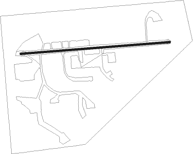
Runway info
| Runway 6 / 24 | ||
| length | 601m (1972ft) | |
| bearing | 90° / 270° | |
| width | 8m (26ft) | |
| surface | asphalt | |
Nearby beacons
| code | identifier | dist | bearing | frequency |
|---|---|---|---|---|
| BGQ | BIG LAKE VORTAC | 23.4 | 271° | 112.50 |
| EDF | ELMENDORF (ANCHORAGE) TACAN | 25.3 | 244° | 113.40 |
| TED | ANCHORAGE VOR/DME | 32.9 | 245° | 113.15 |
| TKA | TALKEETNA VOR/DME | 52.2 | 308° | 116.20 |
| PEE | PETERS CREEK (TALKEETNA) NDB | 53.7 | 309° | 305 |
Disclaimer
The information on this website is not for real aviation. Use this data with the X-Plane flight simulator only! Data taken with kind consent from X-Plane 12 source code and data files. Content is subject to change without notice.