Port Mcneill
Airport details
| Country | Canada |
| State | British Columbia |
| Region | CY |
| Airspace | Vancouver Ctr |
| Municipality | Area C (Hyde Creek/Benson Valley) |
| Elevation | 208ft (63m) |
| Timezone | GMT -8 |
| Coordinates | 50.57555, -127.02861 |
| Magnetic var | |
| Type | land |
| Available since | X-Plane v10.40 |
| ICAO code | AT5 |
| IATA code | YMP |
| FAA code | n/a |
Communication
| Port McNeill CATF | 122.000 |
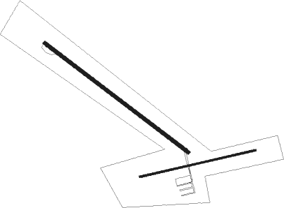
Runway info
Runway 11 / 29  | ||
| length | 1112m (3648ft) | |
| bearing | 120° / 300° | |
| width | 23m (75ft) | |
| surface | gravel | |
| displ threshold | 107m (351ft) / 31m (102ft) | |
| Runway 06 / 24 | ||
| length | 732m (2402ft) | |
| bearing | 84° / 264° | |
| width | 11m (36ft) | |
| surface | asphalt | |
| blast zone | 0m (0ft) / 27m (89ft) | |
Nearby beacons
| code | identifier | dist | bearing | frequency |
|---|---|---|---|---|
| YZT | PORT HARDY VOR/DME | 14.3 | 288° | 112 |
| ZT | PORT HARDY NDB | 16.9 | 287° | 242 |
Disclaimer
The information on this website is not for real aviation. Use this data with the X-Plane flight simulator only! Data taken with kind consent from X-Plane 12 source code and data files. Content is subject to change without notice.