Monarto South - Ferries-mcdonald Airfield
Airport details
| Country | Australia |
| State | South Australia |
| Region | YM |
| Airspace | Melbourne Ctr |
| Municipality | The Rural City of Murray Bridge |
| Elevation | 310ft (94m) |
| Timezone | GMT +10.5 |
| Coordinates | -35.17761, 139.11201 |
| Magnetic var | |
| Type | land |
| Available since | X-Plane v10.40 |
| ICAO code | AU01 |
| IATA code | n/a |
| FAA code | n/a |
Communication
| Ferries-McDonald Airfield CTAF | 126.700 |
Nearby Points of Interest:
Lake Alexandrina
-Clarendon Weir
-Benacre
-Happy Valley Reservoir
-Attunga
-Torrens Building
-Bonython Hall
-Adelaide Town Hall
-State Library of South Australia
-Beehive Corner
-Government House
-Parliament House of South Australia
-Queen's Theatre
-Torrens Parade Ground
-North Road Cemetery
-Yatala Labour Prison
-Mount Breckan
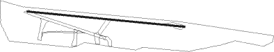
Runway info
| Runway 10 / 28 | ||
| length | 852m (2795ft) | |
| bearing | 98° / 278° | |
| width | 9m (30ft) | |
| surface | gravel | |
Nearby beacons
| code | identifier | dist | bearing | frequency |
|---|---|---|---|---|
| AD | ADELAIDE VOR/DME | 32 | 291° | 116.40 |
| PF | PARAFIELD (ADELAIDE) NDB | 32.9 | 308° | 416 |
| EDN | EDINBURGH (ADELAIDE) TACAN | 37.5 | 313° | 110.30 |
Disclaimer
The information on this website is not for real aviation. Use this data with the X-Plane flight simulator only! Data taken with kind consent from X-Plane 12 source code and data files. Content is subject to change without notice.