Londolovit - Lihir (kunaye)
Airport details
| Country | Papua New Guinea |
| State | New Ireland |
| Region | AY |
| Airspace | Port Moresby Ctr |
| Elevation | 166ft (51m) |
| Timezone | GMT +10 |
| Coordinates | -3.04361, 152.62900 |
| Magnetic var | |
| Type | land |
| Available since | X-Plane v10.40 |
| ICAO code | AYKY |
| IATA code | LNV |
| FAA code | n/a |
Communication
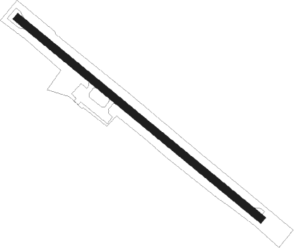
Runway info
| Runway 12 / 30 | ||
| length | 1200m (3937ft) | |
| bearing | 134° / 314° | |
| width | 30m (98ft) | |
| surface | gravel | |
Nearby beacons
| code | identifier | dist | bearing | frequency |
|---|---|---|---|---|
| LHR | LIHIR NDB | 0.1 | 245° | 218 |
Instrument approach procedures
| runway | airway (heading) | route (dist, bearing) |
|---|---|---|
| RWNVA | YKYWD (108°) | YKYWD 3700ft YKYWI (5mi, 44°) 3000ft |
| RWNVA | YKYWE (134°) | YKYWE 3700ft YKYWI (5mi, 134°) 3000ft |
| RWNVA | YKYWG (160°) | YKYWG 3700ft YKYWI (5mi, 224°) 3000ft |
| RNAV | YKYWI 3000ft YKYWF (5mi, 134°) 1800ft YKYWM (5mi, 134°) 243ft YKYWH (5mi, 134°) (9160mi, 271°) 3700ft | |
| RWNVB | YKYEA (288°) | YKYEA 3700ft YKYEI (5mi, 224°) 3000ft |
| RWNVB | YKYEB (314°) | YKYEB 3700ft YKYEI (5mi, 314°) 3000ft |
| RWNVB | YKYEC (340°) | YKYEC 3700ft YKYEI (5mi, 44°) 3000ft |
| RNAV | YKYEI 3000ft YKYEF (5mi, 314°) 1800ft YKYEM (5mi, 314°) 187ft YKYEH (5mi, 314°) (9154mi, 271°) 3700ft |
Disclaimer
The information on this website is not for real aviation. Use this data with the X-Plane flight simulator only! Data taken with kind consent from X-Plane 12 source code and data files. Content is subject to change without notice.