Misima Island
Airport details
| Country | Papua New Guinea |
| State | Milne Bay |
| Region | AY |
| Airspace | Port Moresby Ctr |
| Municipality | Misima District |
| Elevation | 20ft (6m) |
| Timezone | GMT +10 |
| Coordinates | -10.68907, 152.83757 |
| Magnetic var | |
| Type | land |
| Available since | X-Plane v10.40 |
| ICAO code | AYMS |
| IATA code | MIS |
| FAA code | n/a |
Communication
| Misima Island MIS AWOS | 127.700 |
Runway info
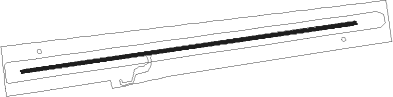
| Runway 08 / 26 | ||
| length | 1075m (3527ft) | |
| bearing | 86° / 266° | |
| width | 10m (33ft) | |
| surface | dirt | |
Instrument approach procedures
| runway | airway (heading) | route (dist, bearing) |
|---|---|---|
| RWNVA | YMSWA (48°) | YMSWA 4700ft YMSWI (5mi, 344°) 2300ft |
| RWNVA | YMSWI (72°) | YMSWB 4700ft YMSWI (5mi, 75°) 2300ft |
| RNAV | YMSWI 2300ft YMSWF (5mi, 75°) 2000ft YMSWZ (2mi, 75°) 1760ft YMSWM (4mi, 75°) 1450ft YMSWH (5mi, 75°) (9071mi, 274°) 3000ft | |
| RWNVB | YMSEA (240°) | YMSEA 3000ft YMSEI (5mi, 172°) 3000ft |
| RWNVB | YMSEB (263°) | YMSEB 3000ft YMSEI (5mi, 262°) 3000ft |
| RWNVB | YMSEC (286°) | YMSEC 3000ft YMSEI (5mi, 352°) 3000ft |
| RNAV | YMSEI 3000ft YMSEF (5mi, 262°) 2000ft YMSEM (4mi, 262°) 700ft YMSEH (8mi, 226°) (9061mi, 274°) 3000ft |
Disclaimer
The information on this website is not for real aviation. Use this data with the X-Plane flight simulator only! Data taken with kind consent from X-Plane 12 source code and data files. Content is subject to change without notice.