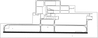
Lae - Nadzab
Airport details
| Country | Papua New Guinea |
| State | Morobe |
| Region | AY |
| Airspace | Port Moresby Ctr |
| Municipality | Lae District |
| Elevation | 236ft (72m) |
| Timezone | GMT +10 |
| Coordinates | -6.56661, 146.72980 |
| Magnetic var | |
| Type | land |
| Available since | X-Plane v10.40 |
| ICAO code | AYNZ |
| IATA code | LAE |
| FAA code | n/a |
Communication
| Nadzab LAE AWOS | 128.600 |
| Nadzab LAE TOWER | 121.700 |
Nearby beacons
| code | identifier | dist | bearing | frequency |
|---|---|---|---|---|
| NZ | NADZAB VOR/DME | 1.2 | 265° | 113.90 |
Instrument approach procedures
| runway | airway (heading) | route (dist, bearing) |
|---|---|---|
| RW09 | OPIGO (335°) | OPIGO LARID (30mi, 355°) 7600ft YNZWA (28mi, 275°) 6900ft YNZWI (9mi, 5°) 3300ft |
| RW09 | WESFI (93°) | WESFI 6900ft YNZWI (8mi, 92°) 3300ft |
| RNAV | YNZWI 3300ft YNZWF (5mi, 95°) 1900ft YNZWM (5mi, 95°) 288ft YNZWH (5mi, 95°) LARID (15mi, 129°) (8792mi, 273°) 7600ft | |
| RW27 | OPIGO (335°) | OPIGO LARID (30mi, 355°) 7600ft YNZEI (10mi, 333°) 3600ft |
| RNAV | YNZEI 3600ft YNZEZ (2mi, 275°) 3010ft YNZEF (3mi, 275°) 1900ft YNZEM (5mi, 275°) 269ft YNZEH (5mi, 275°) (8774mi, 273°) 2700ft LARID (8792mi, 93°) 7600ft |
Disclaimer
The information on this website is not for real aviation. Use this data with the X-Plane flight simulator only! Data taken with kind consent from X-Plane 12 source code and data files. Content is subject to change without notice.
