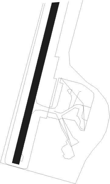
Nuuk
Airport details
| Country | Greenland |
| State | [Other] |
| Region | BG |
| Airspace | Nuuk Ctr |
| Municipality | Nuuk |
| Elevation | 282ft (86m) |
| Timezone | GMT -3 |
| Coordinates | 64.19093, -51.67806 |
| Magnetic var | |
| Type | land |
| Available since | X-Plane v10.40 |
| ICAO code | BGGH |
| IATA code | GOH |
| FAA code | n/a |
Communication
| Nuuk Nuuk Information | 121.300 |
| Nuuk AFIS | 119.100 |
Approach frequencies
| LOC | RW22 | 110.3 | 18.00mi |
Nearby beacons
| code | identifier | dist | bearing | frequency |
|---|---|---|---|---|
| GH | NUUK NDB | 1.9 | 261° | 314 |
| KU | KOOK ISLANDS NDB | 11.3 | 250° | 298 |
Instrument approach procedures
| runway | airway (heading) | route (dist, bearing) |
|---|---|---|
| RW22 | ABMUL (218°) | ABMUL 6800ft GHI22 (6mi, 218°) 4400ft |
| RW22 | GIREG (245°) | GIREG 6800ft 3NM (3mi, 278°) 5400ft GHI22 (3mi, 278°) 4400ft |
| RW22 | IBUMA (176°) | IBUMA 5000ft GHI22 (5mi, 98°) 4400ft |
| RNAV | GHI22 4400ft GHF22 (6mi, 218°) 3000ft GH22M (6mi, 218°) 786ft GH231 (6mi, 258°) GH232 (4mi, 311°) IBUMA (13mi, 50°) IBUMA (turn) 4400ft | |
| RWNVA | ADKUT (331°) | ADKUT 6100ft GONEN (5mi, 279°) 3700ft ELTUX (5mi, 0°) 2500ft |
| RWNVA | NIPOT (44°) | NIPOT 5500ft GONEN (5mi, 81°) 3300ft ELTUX (5mi, 0°) 2500ft |
| RWNVA | UVIRI (12°) | UVIRI 4700ft GONEN (5mi, 0°) 3300ft ELTUX (5mi, 0°) 2500ft |
| RNAV | ELTUX 2500ft ADMIP (5mi, 0°) 780ft (4464mi, 141°) 1500ft NIPOT (4461mi, 321°) NIPOT (turn) 3300ft | |
| RWNVB | TUNDO (116°) | TUNDO 4500ft GHI41 (5mi, 88°) 2800ft |
| RWNVB | UMVUR (142°) | UMVUR 4700ft GHI41 (5mi, 135°) 2800ft |
| RWNVB | VETEM (215°) | VETEM 6800ft GHI41 (10mi, 248°) 2800ft |
| RNAV | GHI41 2800ft GHF41 (5mi, 135°) 1700ft GHM41 (4mi, 195°) 780ft GH411 (4mi, 254°) GH412 (3mi, 282°) TUNDO (9mi, 358°) 2800ft TUNDO (turn) 2800ft |
Disclaimer
The information on this website is not for real aviation. Use this data with the X-Plane flight simulator only! Data taken with kind consent from X-Plane 12 source code and data files. Content is subject to change without notice.
