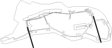
Thule - Thule Air Base
Airport details
| Country | Greenland |
| State | Pituffik |
| Region | BG |
| Airspace | Nuuk Ctr |
| Elevation | 251ft (77m) |
| Timezone | GMT -4 |
| Coordinates | 76.53120, -68.70316 |
| Magnetic var | |
| Type | land |
| Available since | X-Plane v10.40 |
| ICAO code | BGTL |
| IATA code | THU |
| FAA code | n/a |
Communication
| Thule Air Base Ground Control | 119.900 |
| Thule Air Base Tower | 126.200 |
| Thule Air Base Approach | 134.100 |
Approach frequencies
| ILS-cat-I | RW08T | 109.5 | 18.00mi |
| 3° GS | RW08T | 109.5 | 18.00mi |
Nearby beacons
| code | identifier | dist | bearing | frequency |
|---|---|---|---|---|
| THT | THULE VORTAC | 6.5 | 89° | 111 |
| QAANAAQ NDB | 57.5 | 327° | 336 | |
| QN | DME-ILS | 58.1 | 325° | 108.35 |
Departure and arrival routes
| Transition altitude | 6500ft |
| Transition level | 9000ft |
| SID end points | distance | outbound heading | |
|---|---|---|---|
| RW08T | |||
| WENSA2 | 24mi | 268° | |
| RW26T | |||
| THULE1, WENSA2 | 24mi | 268° | |
Instrument approach procedures
| runway | airway (heading) | route (dist, bearing) |
|---|---|---|
| RW08T | MAARE (231°) | MAARE 6000ft NUTEE (27mi, 262°) 6000ft SUNDD (10mi, 154°) 5000ft |
| RW08T | MRTNN (30°) | MRTNN 8000ft CASBI (15mi, 279°) 5000ft SUNDD (10mi, 335°) 5000ft |
| RW08T | SUNDD (89°) | SUNDD 5000ft |
| RNAV | SUNDD 5000ft BELLL (10mi, 89°) 1900ft BGTL (6mi, 89°) 217ft (5114mi, 138°) 960ft SUNDD (5128mi, 318°) 5000ft SUNDD (turn) |
Disclaimer
The information on this website is not for real aviation. Use this data with the X-Plane flight simulator only! Data taken with kind consent from X-Plane 12 source code and data files. Content is subject to change without notice.
