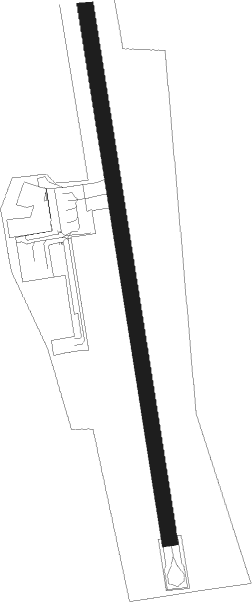
Akureyri
Airport details
| Country | Iceland |
| State | Northeastern Region (Iceland) |
| Region | BI |
| Airspace | Reykjavik Ctr |
| Municipality | Akureyrarbær |
| Elevation | 4ft (1m) |
| Timezone | GMT +0 |
| Coordinates | 65.65667, -18.07195 |
| Magnetic var | |
| Type | land |
| Available since | X-Plane v10.30 |
| ICAO code | BIAR |
| IATA code | AEY |
| FAA code | n/a |
Communication
| Akureyri Tower | 118.200 |
| Akureyri RADAR | 118.700 |
Approach frequencies
| LOC | RW01 | 111.9 | 18.00mi |
| ILS-cat-I | RW01 | 108.9 | 18.00mi |
| ILS-cat-I | RW19 | 110.5 | 18.00mi |
| 5.3° GS | RW01 | 108.9 | 18.00mi |
| 3.4° GS | RW19 | 110.5 | 18.00mi |
Nearby beacons
| code | identifier | dist | bearing | frequency |
|---|---|---|---|---|
| MOB | MOB TACAN | 1.2 | 169° | 114.80 |
| OE | ODDEYRI (AKUREYRI) NDB | 1.7 | 349° | 415 |
| KN | KRISTNES (AKUREYRI) NDB | 4.2 | 169° | 364 |
| AR | AKUREYRI NDB | 5.9 | 350° | 334 |
| AKI | AKUREYRI VOR/DME | 6.4 | 33° | 113.60 |
| TO | TORFUR (AKUREYRI) NDB | 9.5 | 207° | 324 |
| HJ | HJALTEYRI (AKUREYRI) NDB | 12 | 328° | 319 |
| GA | GARDUR (HUSAVIK) NDB | 20 | 70° | 377 |
| NB | BOTN (AKUREYRI) NDB | 20.6 | 214° | 387 |
| HS | HUSAVIK NDB | 22.5 | 67° | 329 |
Departure and arrival routes
| Transition altitude | 7000ft |
| SID end points | distance | outbound heading | |
|---|---|---|---|
| RW01 | |||
| UTIS2A | 23mi | 73° | |
| MAME1A | 18mi | 87° | |
| ASKU1B, ASKU1A | 32mi | 233° | |
| PERU1A, PERU1B | 26mi | 256° | |
| RW19 | |||
| RETU1D | 13mi | 105° | |
| JARI1C, JARI1D, JARI1E | 27mi | 170° | |
| ASKU1D, ASKU1C, ASKU1E | 32mi | 233° | |
| PERU1D | 26mi | 256° | |
| STAR starting points | distance | inbound heading | |
|---|---|---|---|
| RW19 | |||
| PERU1N | 25.5 | 76° | |
| AFPA1M | 20.2 | 100° | |
| BEZI1M | 25.5 | 117° | |
| CUBA1M | 29.6 | 142° | |
| DORF1M | 28.7 | 160° | |
| UTIS1N, UTIS1M | 22.5 | 253° | |
| MAME1M, MAME1N | 18.1 | 267° | |
| PEXI1N, PEXI1M | 15.1 | 355° | |
Instrument approach procedures
| runway | airway (heading) | route (dist, bearing) |
|---|---|---|
| RW19-X | AKI (213°) | AKI 5600ft AR691 (3mi, 46°) AR692 (3mi, 318°) 4700ft AR693 (2mi, 270°) 4100ft ARI69 (3mi, 232°) 2500ft |
| RW19-X | GITTA (238°) | GITTA 6000ft AR692 (5mi, 282°) 4700ft AR693 (2mi, 270°) 4100ft ARI69 (3mi, 232°) 2500ft |
| RNAV | ARI69 2500ft SAGGO (3mi, 162°) 2500ft ARM69 (6mi, 162°) 232ft AR695 (3mi, 162°) AR696 (turn) TO (7mi, 220°) NB (11mi, 219°) AR594 (6mi, 219°) (3998mi, 164°) 6000ft NB (4003mi, 344°) 7000ft NB (turn) 7000ft | |
| RW19-Y | ARLAX (235°) | ARLAX 6000ft AR490 (4mi, 275°) 4800ft 2NM (2mi, 263°) 4200ft REFUM (2mi, 263°) 3600ft |
| RW19-Y | NORFI (141°) | NORFI 6000ft AR489 (4mi, 123°) 4000ft REFUM (4mi, 123°) 3600ft |
| RNAV | REFUM 3600ft SAGGO (4mi, 162°) 2500ft ARM49 (6mi, 162°) 360ft AR495 (4mi, 162°) AR496 (3mi, 215°) NB (15mi, 219°) AR594 (6mi, 219°) (3998mi, 164°) 6000ft NB (4003mi, 344°) NB (turn) 7000ft |
Disclaimer
The information on this website is not for real aviation. Use this data with the X-Plane flight simulator only! Data taken with kind consent from X-Plane 12 source code and data files. Content is subject to change without notice.
