Húsafell - Husafell
Airport details
| Country | Iceland |
| State | Western Region |
| Region | BI |
| Airspace | Reykjavik Ctr |
| Municipality | Borgarbyggð |
| Elevation | 384ft (117m) |
| Timezone | GMT +0 |
| Coordinates | 64.69972, -20.88361 |
| Magnetic var | |
| Type | land |
| Available since | X-Plane v10.30 |
| ICAO code | BIHZ |
| IATA code | n/a |
| FAA code | n/a |
Communication
| Husafell AFIS | 118.100 |
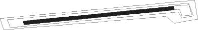
Runway info
| Runway 10 / 28 | ||
| length | 741m (2431ft) | |
| bearing | 89° / 269° | |
| width | 18m (59ft) | |
| surface | gravel | |
Nearby beacons
| code | identifier | dist | bearing | frequency |
|---|---|---|---|---|
| RH | REYKHOLT NDB | 10.5 | 265° | 325 |
| EL | ELLIDAVATN NDB | 43.7 | 235° | 335 |
| SE | SELFOSS NDB | 46.4 | 191° | 397 |
| BL | BLONDUOS NDB | 61 | 31° | 351 |
Disclaimer
The information on this website is not for real aviation. Use this data with the X-Plane flight simulator only! Data taken with kind consent from X-Plane 12 source code and data files. Content is subject to change without notice.