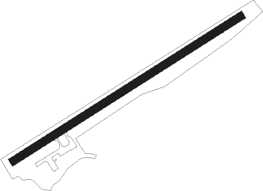
Ísafjörður - Isafjordur
Airport details
| Country | Iceland |
| State | Westfjords |
| Region | BI |
| Airspace | Reykjavik Ctr |
| Municipality | Ísafjarðarbær |
| Elevation | 2ft (1m) |
| Timezone | GMT +0 |
| Coordinates | 66.05805, -23.13528 |
| Magnetic var | |
| Type | land |
| Available since | X-Plane v10.40 |
| ICAO code | BIIS |
| IATA code | IFJ |
| FAA code | n/a |
Communication
| Isafjordur Isafjordur Weather | 135.000 |
| Isafjordur Isafjordur Radio | 118.800 |
| Isafjordur Reykjavik ACC | 119.700 |
Nearby beacons
| code | identifier | dist | bearing | frequency |
|---|---|---|---|---|
| IS | ISAFJORDUR NDB | 3.3 | 67° | 385 |
| OG | DME-ILS | 11 | 92° | 110.10 |
| RE | REYKJANESSKOLI (ISAFJORDUR) NDB | 18.9 | 101° | 316 |
| SB | SELARDALUR NDB | 26.4 | 253° | 310 |
Departure and arrival routes
| Transition altitude | 7000ft |
| Transition level | 7000ft |
| SID end points | distance | outbound heading | |
|---|---|---|---|
| RW08 | |||
| RE1A | 19mi | 101° | |
| ISAC1A | 17mi | 119° | |
Instrument approach procedures
| runway | airway (heading) | route (dist, bearing) |
|---|---|---|
| RWNVC | ABETU (174°) | ABETU 4600ft ISI41 (5mi, 251°) 3000ft |
| RWNVC | BANLA (114°) | BANLA 4400ft ISI41 (5mi, 71°) 3000ft |
| RWNVC | ELVOR (131°) | ELVOR 3300ft ISI41 (5mi, 115°) 3000ft |
| RNAV | ISI41 3000ft ISF42 (5mi, 115°) 2000ft ISM43 (5mi, 115°) 1200ft ISI51 (12mi, 104°) KUMUX (5mi, 103°) KUMUX (turn) 4000ft | |
| RWNVD | AMKIN (283°) | AMKIN 4800ft ISI51 (5mi, 21°) 3000ft |
| RWNVD | ELGUT (268°) | ELGUT 4600ft ISI51 (5mi, 251°) 3000ft |
| RWNVD | KUMUX (276°) | KUMUX 4600ft ISI51 (5mi, 283°) 3000ft |
| RNAV | ISI51 3000ft ISF52 (5mi, 283°) 1900ft ISM53 (5mi, 283°) 500ft (4091mi, 161°) 3500ft AMKIN (4078mi, 341°) AMKIN (turn) 4000ft |
Disclaimer
The information on this website is not for real aviation. Use this data with the X-Plane flight simulator only! Data taken with kind consent from X-Plane 12 source code and data files. Content is subject to change without notice.
